Uenglingen geodata
Uenglingen (Saxony-Anhalt) is a populated place; located in Germany in Europe/Berlin (GMT+2) time zone. With population of 1,053 people, there are 6991 cities with bigger population in this country. Compared to other cities in Germany, 79% of cities are located further ↓South; 78.9% of cities are located further ←West and 82.8% of cities have higher elevation than Uenglingen. Note1


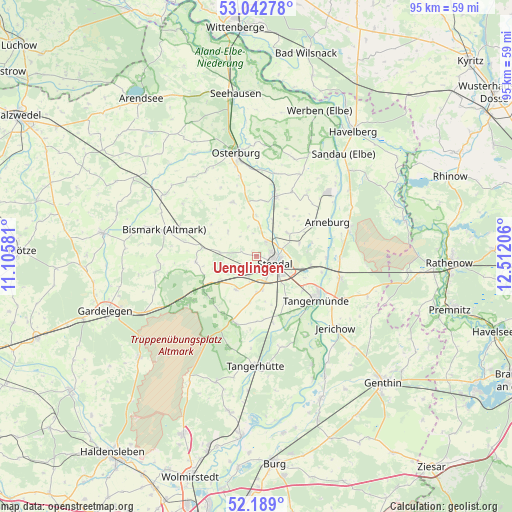
Uenglingen GPS coordinates[2]
52° 37' 4.692" North, 11° 48' 32.148" East
| Map corner | latitude | longitude |
|---|---|---|
| Upper-left | 53.04278°, | 11.10581° |
| Center: | 52.61797°, | 11.80893° |
| Lower-right: | 52.189°, | 12.51206° |
| Map W x H: | 94.9×94.9 km | = 59×59mi |
| max Lat: | 55.01917° ⇑21% North |
| Uenglingen: | 52.61797° |
| min Lat: | ⇓79% South 47.40724° |
| min Long | Uenglingen | max Long |
| 5.92978° | 11.80893° | 14.98853° |
| W 78.9%⇐ | ⇒21.1% E |
Elevation
Elevation of Uenglingen is 40 m = 131 ft, and this is 209.1 m = 686 ft below average elevation for this country.
| Max E: |
1256 m = 4121 ft | 82.8% |
| Avg. | 249.1 m = 817 ft | |
| Uenglingen | 40 m = 131 ft | |
Min E: |
-5 m = -16 ft | 17.2% |
See also: Germany elevation on elevation.city.
Geographical zone
Uenglingen is located in North temperate zone (between Tropic of Cancer and the Arctic Circle). Distance of this North polar circle is 1550.6 km =963.5 mi to North.| Distance of | km | miles | from Uenglingen |
|---|---|---|---|
| North Pole | 4156.5 | 2582.7 | to North |
| Arctic Circle | 1550.6 | 963.5 | to North |
| Tropic Cancer | 3244.7 | 2016.2 | to South |
| Equator | 5850.6 | 3635.4 | to South |


Nearby cities:
15 places around Uenglingen: (largest is in red/bold)
• Arneburg
14.7 km =9.1 mi,  64°
64°
• Badingen
11.3 km =7 mi,  264°
264°
• Dahlen
6.5 km =4 mi,  169°
169°
• Erxleben
15 km =9.3 mi,  349°
349°
• Goldbeck
11.5 km =7.1 mi,  17°
17°
• Hassel
8.3 km =5.2 mi,  73°
73°
• Heeren
9.9 km =6.2 mi,  147°
147°
• Insel
7.3 km =4.5 mi,  210°
210°
• Jarchau
7.2 km =4.5 mi,  54°
54°
• Kläden
10.1 km =6.3 mi,  278°
278°
• Lüderitz
12.9 km =8 mi,  200°
200°
• Möringen
5.2 km =3.2 mi,  235°
235°
• Rochau
10.8 km =6.7 mi,  336°
336°
• Stendal
3.6 km =2.2 mi,  110°
110°
• Tangermünde
14 km =8.7 mi,  125°
125°
Sources, notices
• [Note1] Compared only with cities in Germany existing in our database
• [Src1] Map data: © OpenStreetMap contributors (CC-BY-SA)
• [Src2] Other city data from geonames.org with taken over terms of usage.
• [Src3] Geographical zone / Annual Mean Temperature by Robert A. Rohde @ Wikipedia
