Kubschütz geodata
Kubschütz (Saxony) is a seat of a fourth-order administrative division; located in Germany in Europe/Berlin (GMT+2) time zone. With population of 2,932 people, there are 4061 cities with bigger population in this country. Compared to other cities in Germany, 61% of cities are located further ↓South; 99.3% of cities are located further ←West and 50.9% of cities have higher elevation than Kubschütz. Note1


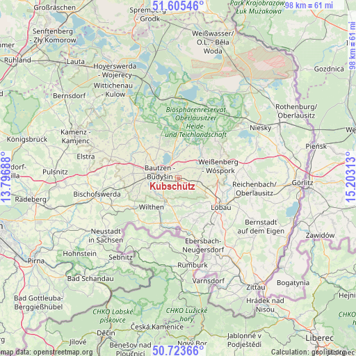
Kubschütz GPS coordinates[2]
51° 10' 0.012" North, 14° 30' 0" East
| Map corner | latitude | longitude |
|---|---|---|
| Upper-left | 51.60546°, | 13.79688° |
| Center: | 51.16667°, | 14.5° |
| Lower-right: | 50.72366°, | 15.20313° |
| Map W x H: | 98×98 km | = 60.9×60.9mi |
| max Lat: | 55.01917° ⇑39% North |
| Kubschütz: | 51.16667° |
| min Lat: | ⇓61% South 47.40724° |
| min Long | Kubschütz | max Long |
| 5.92978° | 14.5° | 14.98853° |
| W 99.3%⇐ | ⇒0.7% E |
Elevation
Elevation of Kubschütz is 219 m = 719 ft, and this is 30.1 m = 99 ft below average elevation for this country.
| Max E: |
1256 m = 4121 ft | 50.9% |
| Avg. | 249.1 m = 817 ft | |
| Kubschütz | 219 m = 719 ft | |
Min E: |
-5 m = -16 ft | 49.1% |
See also: Germany elevation on elevation.city.
Geographical zone
Kubschütz is located in North temperate zone (between Tropic of Cancer and the Arctic Circle). Distance of this North polar circle is 1712 km =1063.8 mi to North.| Distance of | km | miles | from Kubschütz |
|---|---|---|---|
| North Pole | 4317.9 | 2683 | to North |
| Arctic Circle | 1712 | 1063.8 | to North |
| Tropic Cancer | 3083.3 | 1915.9 | to South |
| Equator | 5689.2 | 3535.1 | to South |


Nearby cities:
15 places around Kubschütz: (largest is in red/bold)
• Bautzen
4.8 km =3 mi,  288°
288°
• Beiersdorf
10.6 km =6.6 mi,  165°
165°
• Crostau
9.6 km =6 mi,  198°
198°
• Cunewalde
7.5 km =4.7 mi, 171°
• Großdubrau
10.1 km =6.3 mi,  343°
343°
• Großpostwitz
6.6 km =4.1 mi,  219°
219°
• Guttau
11.1 km =6.9 mi,  22°
22°
• Hochkirch
5.3 km =3.3 mi,  111°
111°
• Kirschau
9.6 km =6 mi,  211°
211°
• Malschwitz
8 km =5 mi,  10°
10°
• Obergurig
7.6 km =4.7 mi,  240°
240°
• Oppach
11.1 km =6.9 mi,  180°
180°
• Radibor
11.2 km =7 mi,  320°
320°
• Schirgiswalde
11.2 km =7 mi, 206°
• Wilthen
10.7 km =6.6 mi, 224°
Sources, notices
• [Note1] Compared only with cities in Germany existing in our database
• [Src1] Map data: © OpenStreetMap contributors (CC-BY-SA)
• [Src2] Other city data from geonames.org with taken over terms of usage.
• [Src3] Geographical zone / Annual Mean Temperature by Robert A. Rohde @ Wikipedia
