Karben geodata
Karben (Hesse) is a populated place; located in Germany in Europe/Berlin (GMT+2) time zone. With population of 21,642 people, there are 695 cities with bigger population in this country. Compared to other cities in Germany, 58.5% of cities are located further ↑North; 68.3% of cities are located further →East and 65.4% of cities have higher elevation than Karben. Note1
Administrative division(s):
- Level 1: Hesse
- Level 2: Regierungsbezirk Darmstadt
- Level 3: Wetteraukreis
- Level 4: Karben


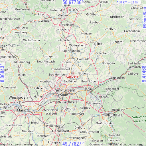
Karben GPS coordinates[2]
50° 13' 48.684" North, 8° 46' 17.58" East
| Map corner | latitude | longitude |
|---|---|---|
| Upper-left | 50.67786°, | 8.06843° |
| Center: | 50.23019°, | 8.77155° |
| Lower-right: | 49.77827°, | 9.47468° |
| Map W x H: | 100×100 km | = 62.1×62.1mi |
| max Lat: | 55.01917° ⇑58.5% North |
| Karben: | 50.23019° |
| min Lat: | ⇓41.5% South 47.40724° |
| min Long | Karben | max Long |
| 5.92978° | 8.77155° | 14.98853° |
| W 31.7%⇐ | ⇒68.3% E |
Elevation
Elevation of Karben is 118 m = 387 ft, and this is 131.1 m = 430 ft below average elevation for this country.
| Max E: |
1256 m = 4121 ft | 65.4% |
| Avg. | 249.1 m = 817 ft | |
| Karben | 118 m = 387 ft | |
Min E: |
-5 m = -16 ft | 34.6% |
See also: Germany elevation on elevation.city.
Geographical zone
Karben is located in North temperate zone (between Tropic of Cancer and the Arctic Circle). Distance of this North polar circle is 1816.1 km =1128.5 mi to North.| Distance of | km | miles | from Karben |
|---|---|---|---|
| North Pole | 4422 | 2747.7 | to North |
| Arctic Circle | 1816.1 | 1128.5 | to North |
| Tropic Cancer | 2979.2 | 1851.2 | to South |
| Equator | 5585.1 | 3470.4 | to South |


Nearby cities:
15 places around Karben: (largest is in red/bold)
• Altenstadt
13.8 km =8.6 mi,  62°
62°
• Bad Homburg vor der Höhe
10.9 km =6.8 mi,  268°
268°
• Bad Vilbel
6.2 km =3.9 mi,  202°
202°
• Bruchköbel
12.2 km =7.6 mi,  118°
118°
• Florstadt
11.8 km =7.3 mi,  35°
35°
• Frankfurt am Main
14.2 km =8.8 mi,  206°
206°
• Friedberg
12 km =7.5 mi,  354°
354°
• Friedrichsdorf
9.4 km =5.8 mi,  283°
283°
• Maintal
9.9 km =6.2 mi,  153°
153°
• Mühlheim am Main
13.4 km =8.3 mi,  160°
160°
• Nidderau
6.8 km =4.2 mi,  82°
82°
• Niederdorfelden
4.5 km =2.8 mi, 153°
• Oberursel
14 km =8.7 mi,  259°
259°
• Offenbach
14.4 km =8.9 mi,  181°
181°
• Rosbach vor der Höhe
10 km =6.2 mi,  324°
324°
Sources, notices
• [Note1] Compared only with cities in Germany existing in our database
• [Src1] Map data: © OpenStreetMap contributors (CC-BY-SA)
• [Src2] Other city data from geonames.org with taken over terms of usage.
• [Src3] Geographical zone / Annual Mean Temperature by Robert A. Rohde @ Wikipedia
