Bockelwitz geodata
Bockelwitz (Saxony) is a populated place; located in Germany in Europe/Berlin (GMT+2) time zone. With population of 2,794 people, there are 4165 cities with bigger population in this country. Compared to other cities in Germany, 61.5% of cities are located further ↓South; 91.9% of cities are located further ←West and 51.5% of cities have higher elevation than Bockelwitz. Note1


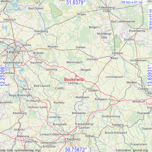
Bockelwitz GPS coordinates[2]
51° 11' 57.912" North, 12° 57' 22.248" East
| Map corner | latitude | longitude |
|---|---|---|
| Upper-left | 51.6379°, | 12.25306° |
| Center: | 51.19942°, | 12.95618° |
| Lower-right: | 50.75672°, | 13.65931° |
| Map W x H: | 98×98 km | = 60.9×60.9mi |
| max Lat: | 55.01917° ⇑38.5% North |
| Bockelwitz: | 51.19942° |
| min Lat: | ⇓61.5% South 47.40724° |
| min Long | Bockelwitz | max Long |
| 5.92978° | 12.95618° | 14.98853° |
| W 91.9%⇐ | ⇒8.1% E |
Elevation
Elevation of Bockelwitz is 215 m = 705 ft, and this is 34.1 m = 112 ft below average elevation for this country.
| Max E: |
1256 m = 4121 ft | 51.5% |
| Avg. | 249.1 m = 817 ft | |
| Bockelwitz | 215 m = 705 ft | |
Min E: |
-5 m = -16 ft | 48.5% |
See also: Germany elevation on elevation.city.
Geographical zone
Bockelwitz is located in North temperate zone (between Tropic of Cancer and the Arctic Circle). Distance of this North polar circle is 1708.3 km =1061.5 mi to North.| Distance of | km | miles | from Bockelwitz |
|---|---|---|---|
| North Pole | 4314.2 | 2680.7 | to North |
| Arctic Circle | 1708.3 | 1061.5 | to North |
| Tropic Cancer | 3086.9 | 1918.1 | to South |
| Equator | 5692.8 | 3537.3 | to South |


Nearby cities:
15 places around Bockelwitz: (largest is in red/bold)
• Colditz
13.3 km =8.3 mi,  233°
233°
• Döbeln
13.8 km =8.6 mi,  128°
128°
• Geringswalde
14.1 km =8.8 mi,  194°
194°
• Gersdorf
9.8 km =6.1 mi, 187°
• Großbothen
14.4 km =8.9 mi,  264°
264°
• Großweitzschen
7.7 km =4.8 mi, 126°
• Hartha
11.3 km =7 mi,  173°
173°
• Leisnig
5.1 km =3.2 mi,  202°
202°
• Mutzschen
8.3 km =5.2 mi,  326°
326°
• Mügeln
7.5 km =4.7 mi,  56°
56°
• Naundorf
12.4 km =7.7 mi, 58°
• Nerchau
14.1 km =8.8 mi,  304°
304°
• Ostrau
5.1 km =3.2 mi,  278°
278°
• Wermsdorf
9.3 km =5.8 mi,  357°
357°
• Zschadrass
11.8 km =7.3 mi, 234°
Sources, notices
• [Note1] Compared only with cities in Germany existing in our database
• [Src1] Map data: © OpenStreetMap contributors (CC-BY-SA)
• [Src2] Other city data from geonames.org with taken over terms of usage.
• [Src3] Geographical zone / Annual Mean Temperature by Robert A. Rohde @ Wikipedia
