Bebra geodata
Bebra (Hesse) is a populated place; located in Germany in Europe/Berlin (GMT+2) time zone. With population of 14,839 people, there are 1072 cities with bigger population in this country. Compared to other cities in Germany, 57.7% of cities are located further ↓South; 52.9% of cities are located further →East and 53.5% of cities have higher elevation than Bebra. Note1
Administrative division(s):
- Level 1: Hesse
- Level 2: Regierungsbezirk Kassel
- Level 3: Landkreis Hersfeld-Rotenburg
- Level 4: Bebra


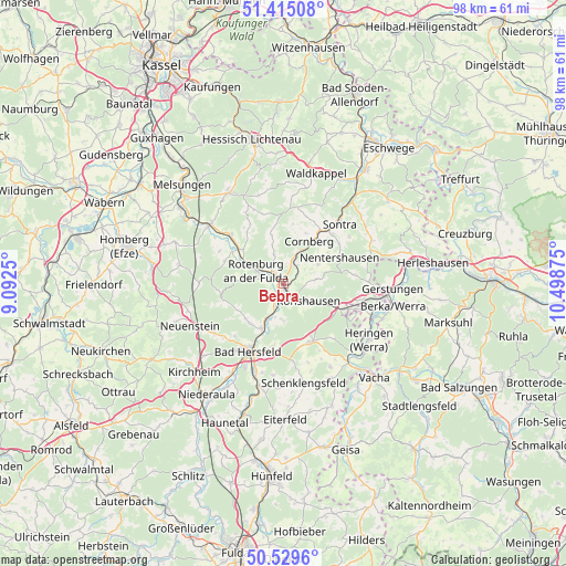
Bebra GPS coordinates[2]
50° 58' 28.02" North, 9° 47' 44.232" East
| Map corner | latitude | longitude |
|---|---|---|
| Upper-left | 51.41508°, | 9.0925° |
| Center: | 50.97445°, | 9.79562° |
| Lower-right: | 50.5296°, | 10.49875° |
| Map W x H: | 98.5×98.5 km | = 61.2×61.2mi |
| max Lat: | 55.01917° ⇑42.3% North |
| Bebra: | 50.97445° |
| min Lat: | ⇓57.7% South 47.40724° |
| min Long | Bebra | max Long |
| 5.92978° | 9.79562° | 14.98853° |
| W 47.1%⇐ | ⇒52.9% E |
Elevation
Elevation of Bebra is 200 m = 656 ft, and this is 49.1 m = 161 ft below average elevation for this country.
| Max E: |
1256 m = 4121 ft | 53.5% |
| Avg. | 249.1 m = 817 ft | |
| Bebra | 200 m = 656 ft | |
Min E: |
-5 m = -16 ft | 46.5% |
See also: Germany elevation on elevation.city.
Geographical zone
Bebra is located in North temperate zone (between Tropic of Cancer and the Arctic Circle). Distance of this North polar circle is 1733.3 km =1077 mi to North.| Distance of | km | miles | from Bebra |
|---|---|---|---|
| North Pole | 4339.2 | 2696.3 | to North |
| Arctic Circle | 1733.3 | 1077 | to North |
| Tropic Cancer | 3061.9 | 1902.6 | to South |
| Equator | 5667.8 | 3521.8 | to South |


Nearby cities:
15 places around Bebra: (largest is in red/bold)
• Alheim
11.1 km =6.9 mi,  305°
305°
• Bad Hersfeld
12.9 km =8 mi,  208°
208°
• Breitenbach
2.2 km =1.4 mi,  204°
204°
• Cornberg
8.7 km =5.4 mi,  31°
31°
• Dankmarshausen
16.4 km =10.2 mi,  109°
109°
• Dippach
18.3 km =11.4 mi, 109°
• Friedewald
11.3 km =7 mi,  153°
153°
• Großensee
12.8 km =8 mi, 110°
• Heringen
17.7 km =11 mi,  122°
122°
• Nentershausen
10.7 km =6.6 mi,  64°
64°
• Ronshausen
4.7 km =2.9 mi,  125°
125°
• Rotenburg an der Fulda
5.3 km =3.3 mi,  296°
296°
• Schenklengsfeld
18 km =11.2 mi,  167°
167°
• Sontra
14.6 km =9.1 mi,  42°
42°
• Spangenberg
18.3 km =11.4 mi,  329°
329°
Sources, notices
• [Note1] Compared only with cities in Germany existing in our database
• [Src1] Map data: © OpenStreetMap contributors (CC-BY-SA)
• [Src2] Other city data from geonames.org with taken over terms of usage.
• [Src3] Geographical zone / Annual Mean Temperature by Robert A. Rohde @ Wikipedia
