Bad Schandau geodata
Bad Schandau (Saxony) is a populated place; located in Germany in Europe/Berlin (GMT+2) time zone. With population of 3,078 people, there are 3933 cities with bigger population in this country. Compared to other cities in Germany, 56.5% of cities are located further ↓South; 98.5% of cities are located further ←West and 63.9% of cities have higher elevation than Bad Schandau. Note1
Administrative division(s):
- Level 1: Saxony
- Level 3: Landkreis Sächsische Schweiz
- Level 4: Bad Schandau


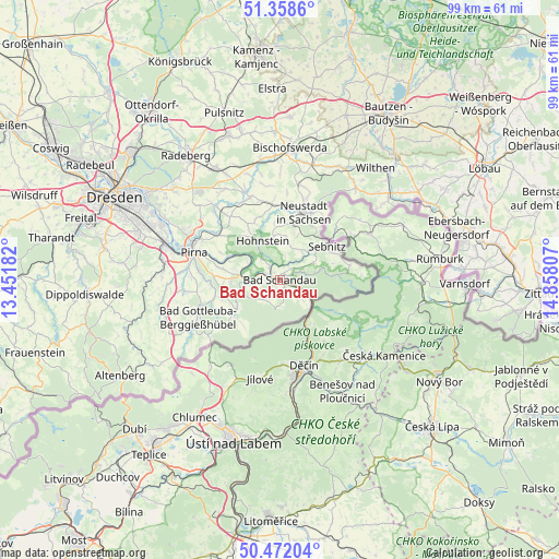
Bad Schandau GPS coordinates[2]
50° 55' 2.748" North, 14° 9' 17.784" East
| Map corner | latitude | longitude |
|---|---|---|
| Upper-left | 51.3586°, | 13.45182° |
| Center: | 50.91743°, | 14.15494° |
| Lower-right: | 50.47204°, | 14.85807° |
| Map W x H: | 98.6×98.6 km | = 61.3×61.3mi |
| max Lat: | 55.01917° ⇑43.5% North |
| Bad Schandau: | 50.91743° |
| min Lat: | ⇓56.5% South 47.40724° |
| min Long | Bad Schandau | max Long |
| 5.92978° | 14.15494° | 14.98853° |
| W 98.5%⇐ | ⇒1.5% E |
Elevation
Elevation of Bad Schandau is 127 m = 417 ft, and this is 122.1 m = 401 ft below average elevation for this country.
| Max E: |
1256 m = 4121 ft | 63.9% |
| Avg. | 249.1 m = 817 ft | |
| Bad Schandau | 127 m = 417 ft | |
Min E: |
-5 m = -16 ft | 36.1% |
See also: Germany elevation on elevation.city.
Geographical zone
Bad Schandau is located in North temperate zone (between Tropic of Cancer and the Arctic Circle). Distance of this North polar circle is 1739.7 km =1081 mi to North.| Distance of | km | miles | from Bad Schandau |
|---|---|---|---|
| North Pole | 4345.6 | 2700.2 | to North |
| Arctic Circle | 1739.7 | 1081 | to North |
| Tropic Cancer | 3055.6 | 1898.7 | to South |
| Equator | 5661.5 | 3517.9 | to South |


Nearby cities:
15 places around Bad Schandau: (largest is in red/bold)
• Berthelsdorf
15.1 km =9.4 mi,  18°
18°
• Dohma
15.5 km =9.6 mi,  269°
269°
• Dürrröhrsdorf
17 km =10.6 mi,  319°
319°
• Hohnstein
7.5 km =4.7 mi,  337°
337°
• Kurort Gohrisch
3.4 km =2.1 mi,  260°
260°
• Königstein
5.8 km =3.6 mi, 268°
• Lohmen
13.3 km =8.3 mi,  306°
306°
• Neustadt in Sachsen
13.1 km =8.1 mi, 19°
• Pirna
15.9 km =9.9 mi,  286°
286°
• Porschdorf
3.3 km =2.1 mi, 324°
• Rathmannsdorf
1.7 km =1.1 mi,  327°
327°
• Sebnitz
10.6 km =6.6 mi,  52°
52°
• Stadt Wehlen
9.8 km =6.1 mi,  297°
297°
• Stolpen
15.6 km =9.7 mi, 340°
• Struppen
9.9 km =6.2 mi,  280°
280°
Sources, notices
• [Note1] Compared only with cities in Germany existing in our database
• [Src1] Map data: © OpenStreetMap contributors (CC-BY-SA)
• [Src2] Other city data from geonames.org with taken over terms of usage.
• [Src3] Geographical zone / Annual Mean Temperature by Robert A. Rohde @ Wikipedia
