Sebnitz geodata
Sebnitz (Saxony) is a populated place; located in Germany in Europe/Berlin (GMT+2) time zone. With population of 9,114 people, there are 1769 cities with bigger population in this country. Compared to other cities in Germany, 57.7% of cities are located further ↓South; 98.9% of cities are located further ←West and 64.7% of cities have lower elevation than Sebnitz. Note1


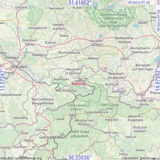
Sebnitz GPS coordinates[2]
50° 58' 31.44" North, 14° 16' 32.844" East
| Map corner | latitude | longitude |
|---|---|---|
| Upper-left | 51.41602°, | 13.57267° |
| Center: | 50.9754°, | 14.27579° |
| Lower-right: | 50.53056°, | 14.97892° |
| Map W x H: | 98.5×98.5 km | = 61.2×61.2mi |
| max Lat: | 55.01917° ⇑42.3% North |
| Sebnitz: | 50.9754° |
| min Lat: | ⇓57.7% South 47.40724° |
| min Long | Sebnitz | max Long |
| 5.92978° | 14.27579° | 14.98853° |
| W 98.9%⇐ | ⇒1.1% E |
Elevation
Elevation of Sebnitz is 319 m = 1047 ft, and this is 69.9 m = 229 ft above average elevation for this country.
| Max E: |
1256 m = 4121 ft | 35.3% |
| Sebnitz | 319 m 1047 ft | |
| Avg. | 249.1 m = 817 ft | |
Min E: |
-5 m = -16 ft | 64.7% |
See also: Germany elevation on elevation.city.
Geographical zone
Sebnitz is located in North temperate zone (between Tropic of Cancer and the Arctic Circle). Distance of this North polar circle is 1733.2 km =1077 mi to North.| Distance of | km | miles | from Sebnitz |
|---|---|---|---|
| North Pole | 4339.1 | 2696.2 | to North |
| Arctic Circle | 1733.2 | 1077 | to North |
| Tropic Cancer | 3062 | 1902.6 | to South |
| Equator | 5667.9 | 3521.9 | to South |


Nearby cities:
15 places around Sebnitz: (largest is in red/bold)
• Bad Schandau
10.6 km =6.6 mi,  232°
232°
• Berthelsdorf
8.8 km =5.5 mi,  334°
334°
• Hohnstein
11.3 km =7 mi,  272°
272°
• Kirschau
16.9 km =10.5 mi,  39°
39°
• Kurort Gohrisch
13.8 km =8.6 mi,  239°
239°
• Königstein
15.8 km =9.8 mi,  245°
245°
• Neukirch/Lausitz
13.7 km =8.5 mi,  9°
9°
• Neustadt in Sachsen
7.2 km =4.5 mi, 325°
• Porschdorf
11.1 km =6.9 mi, 250°
• Rathmannsdorf
10.6 km =6.6 mi, 241°
• Schirgiswalde
15.5 km =9.6 mi, 43°
• Sohland
12.4 km =7.7 mi,  53°
53°
• Steinigtwolmsdorf
10.9 km =6.8 mi,  26°
26°
• Stolpen
16 km =9.9 mi,  300°
300°
• Wilthen
15.8 km =9.8 mi, 31°
Sources, notices
• [Note1] Compared only with cities in Germany existing in our database
• [Src1] Map data: © OpenStreetMap contributors (CC-BY-SA)
• [Src2] Other city data from geonames.org with taken over terms of usage.
• [Src3] Geographical zone / Annual Mean Temperature by Robert A. Rohde @ Wikipedia
