Bad Homburg vor der Höhe geodata
Bad Homburg vor der Höhe (Hesse) is a seat of a third-order administrative division; located in Germany in Europe/Berlin (GMT+2) time zone. With population of 51,859 people, there are 211 cities with bigger population in this country. Compared to other cities in Germany, 58.5% of cities are located further ↑North; 69.9% of cities are located further →East and 55.4% of cities have higher elevation than Bad Homburg vor der Höhe. Note1
Administrative division(s):
- Level 1: Hesse
- Level 2: Regierungsbezirk Darmstadt
- Level 3: Hochtaunuskreis
- Level 4: Bad Homburg v.d. Höhe
Current local time in Bad Homburg vor der Höhe:
03:53 PM, TuesdayDifference from your time zone: hours


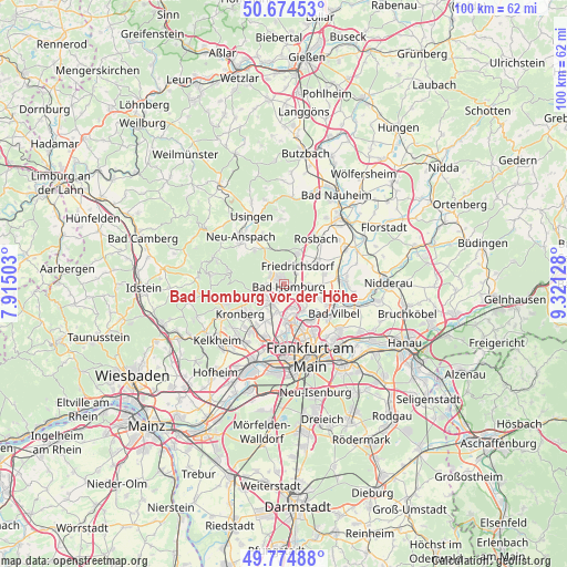
Bad Homburg vor der Höhe GPS coordinates[2]
50° 13' 36.588" North, 8° 37' 5.376" East
| Map corner | latitude | longitude |
|---|---|---|
| Upper-left | 50.67453°, | 7.91503° |
| Center: | 50.22683°, | 8.61816° |
| Lower-right: | 49.77488°, | 9.32128° |
| Map W x H: | 100×100 km | = 62.1×62.1mi |
| max Lat: | 55.01917° ⇑58.5% North |
| Bad Homburg vor der Höhe: | 50.22683° |
| min Lat: | ⇓41.5% South 47.40724° |
| min Long | Bad Homburg vor | max Long |
| 5.92978° | 8.61816° | 14.98853° |
| W 30.1%⇐ | ⇒69.9% E |
Elevation
Elevation of Bad Homburg vor der Höhe is 186 m = 610 ft, and this is 63.1 m = 207 ft below average elevation for this country.
| Max E: |
1256 m = 4121 ft | 55.4% |
| Avg. | 249.1 m = 817 ft | |
| Bad Homburg vor der Höhe | 186 m = 610 ft | |
Min E: |
-5 m = -16 ft | 44.6% |
See also: Bad Homburg vor der Höhe elevation on elevation.city.
Geographical zone
Bad Homburg vor der Höhe is located in North temperate zone (between Tropic of Cancer and the Arctic Circle). Distance of this North polar circle is 1816.5 km =1128.7 mi to North.| Distance of | km | miles | from Bad Homburg vor der Höhe |
|---|---|---|---|
| North Pole | 4422.4 | 2748 | to North |
| Arctic Circle | 1816.5 | 1128.7 | to North |
| Tropic Cancer | 2978.8 | 1850.9 | to South |
| Equator | 5584.7 | 3470.2 | to South |


Nearby cities:
15 places around Bad Homburg vor der Höhe: (largest is in red/bold)
• Bad Soden am Taunus
12.5 km =7.8 mi,  220°
220°
• Bad Vilbel
10 km =6.2 mi,  122°
122°
• Eschborn
9.9 km =6.2 mi,  199°
199°
• Friedrichsdorf
3.1 km =1.9 mi,  34°
34°
• Karben
10.9 km =6.8 mi,  88°
88°
• Kronberg
8.3 km =5.2 mi,  234°
234°
• Kronberg Tal
9.7 km =6 mi,  237°
237°
• Königstein im Taunus
11.7 km =7.3 mi, 243°
• Oberursel
3.6 km =2.2 mi, 233°
• Rosbach vor der Höhe
9.9 km =6.2 mi, 30°
• Schmitten
12.8 km =8 mi,  290°
290°
• Schwalbach am Taunus
10.5 km =6.5 mi, 215°
• Steinbach am Taunus
7.3 km =4.5 mi,  206°
206°
• Sulzbach
12.2 km =7.6 mi, 211°
• Wehrheim
8.9 km =5.5 mi,  335°
335°
Sources, notices
• [Note1] Compared only with cities in Germany existing in our database
• [Src1] Map data: © OpenStreetMap contributors (CC-BY-SA)
• [Src2] Other city data from geonames.org with taken over terms of usage.
• [Src3] Geographical zone / Annual Mean Temperature by Robert A. Rohde @ Wikipedia
