Seeburg geodata
Seeburg (Saxony-Anhalt) is a populated place; located in Germany in Europe/Berlin (GMT+2) time zone. With population of 666 people, there are 8492 cities with bigger population in this country. Compared to other cities in Germany, 66.1% of cities are located further ↓South; 77.3% of cities are located further ←West and 67% of cities have higher elevation than Seeburg. Note1
Administrative division(s):
- Level 1: Saxony-Anhalt
- Level 3: Mansfeld-Südharz
- Level 4: Seegebiet Mansfelder Land


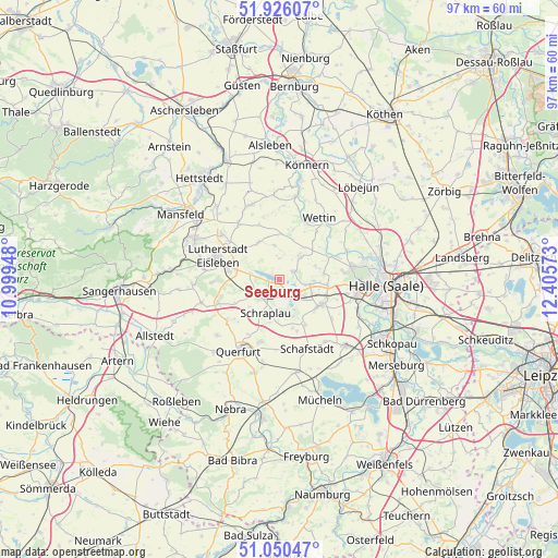
Seeburg GPS coordinates[2]
51° 29' 25.332" North, 11° 42' 9.36" East
| Map corner | latitude | longitude |
|---|---|---|
| Upper-left | 51.92607°, | 10.99948° |
| Center: | 51.49037°, | 11.7026° |
| Lower-right: | 51.05047°, | 12.40573° |
| Map W x H: | 97.4×97.4 km | = 60.5×60.5mi |
| max Lat: | 55.01917° ⇑33.9% North |
| Seeburg: | 51.49037° |
| min Lat: | ⇓66.1% South 47.40724° |
| min Long | Seeburg | max Long |
| 5.92978° | 11.7026° | 14.98853° |
| W 77.3%⇐ | ⇒22.7% E |
Elevation
Elevation of Seeburg is 108 m = 354 ft, and this is 141.1 m = 463 ft below average elevation for this country.
| Max E: |
1256 m = 4121 ft | 67% |
| Avg. | 249.1 m = 817 ft | |
| Seeburg | 108 m = 354 ft | |
Min E: |
-5 m = -16 ft | 33% |
See also: Germany elevation on elevation.city.
Geographical zone
Seeburg is located in North temperate zone (between Tropic of Cancer and the Arctic Circle). Distance of this North polar circle is 1676 km =1041.4 mi to North.| Distance of | km | miles | from Seeburg |
|---|---|---|---|
| North Pole | 4281.9 | 2660.6 | to North |
| Arctic Circle | 1676 | 1041.4 | to North |
| Tropic Cancer | 3119.3 | 1938.2 | to South |
| Equator | 5725.2 | 3557.5 | to South |


Nearby cities:
15 places around Seeburg: (largest is in red/bold)
• Alberstedt
7.2 km =4.5 mi,  228°
228°
• Amsdorf
3.3 km =2.1 mi,  149°
149°
• Erdeborn
5 km =3.1 mi,  250°
250°
• Esperstedt
7.6 km =4.7 mi,  192°
192°
• Hedersleben
7.5 km =4.7 mi,  330°
330°
• Höhnstedt
2.8 km =1.7 mi,  61°
61°
• Langenbogen
5.3 km =3.3 mi,  98°
98°
• Lüttchendorf
5.4 km =3.4 mi,  283°
283°
• Röblingen am See
3.7 km =2.3 mi,  202°
202°
• Schochwitz
5.9 km =3.7 mi,  38°
38°
• Schraplau
6.3 km =3.9 mi, 202°
• Stedten
5.3 km =3.3 mi, 187°
• Teutschenthal
8.1 km =5 mi,  123°
123°
• Wansleben
4.7 km =2.9 mi,  134°
134°
• Zappendorf
6.8 km =4.2 mi,  70°
70°
Sources, notices
• [Note1] Compared only with cities in Germany existing in our database
• [Src1] Map data: © OpenStreetMap contributors (CC-BY-SA)
• [Src2] Other city data from geonames.org with taken over terms of usage.
• [Src3] Geographical zone / Annual Mean Temperature by Robert A. Rohde @ Wikipedia
