Stedten geodata
Stedten (Saxony-Anhalt) is a populated place; located in Germany in Europe/Berlin (GMT+2) time zone. With population of 1,115 people, there are 6810 cities with bigger population in this country. Compared to other cities in Germany, 65.4% of cities are located further ↓South; 77.1% of cities are located further ←West and 66.5% of cities have higher elevation than Stedten. Note1
Administrative division(s):
- Level 1: Saxony-Anhalt
- Level 3: Mansfeld-Südharz
- Level 4: Seegebiet Mansfelder Land


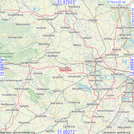
Stedten GPS coordinates[2]
51° 26' 35.088" North, 11° 41' 34.476" East
| Map corner | latitude | longitude |
|---|---|---|
| Upper-left | 51.87923°, | 10.98979° |
| Center: | 51.44308°, | 11.69291° |
| Lower-right: | 51.00272°, | 12.39604° |
| Map W x H: | 97.5×97.5 km | = 60.6×60.6mi |
| max Lat: | 55.01917° ⇑34.6% North |
| Stedten: | 51.44308° |
| min Lat: | ⇓65.4% South 47.40724° |
| min Long | Stedten | max Long |
| 5.92978° | 11.69291° | 14.98853° |
| W 77.1%⇐ | ⇒22.9% E |
Elevation
Elevation of Stedten is 111 m = 364 ft, and this is 138.1 m = 453 ft below average elevation for this country.
| Max E: |
1256 m = 4121 ft | 66.5% |
| Avg. | 249.1 m = 817 ft | |
| Stedten | 111 m = 364 ft | |
Min E: |
-5 m = -16 ft | 33.5% |
See also: Germany elevation on elevation.city.
Geographical zone
Stedten is located in North temperate zone (between Tropic of Cancer and the Arctic Circle). Distance of this North polar circle is 1681.2 km =1044.6 mi to North.| Distance of | km | miles | from Stedten |
|---|---|---|---|
| North Pole | 4287.1 | 2663.9 | to North |
| Arctic Circle | 1681.2 | 1044.6 | to North |
| Tropic Cancer | 3114 | 1934.9 | to South |
| Equator | 5719.9 | 3554.2 | to South |


Nearby cities:
15 places around Stedten: (largest is in red/bold)
• Alberstedt
4.7 km =2.9 mi,  276°
276°
• Amsdorf
3.4 km =2.1 mi,  44°
44°
• Dornstedt
5.1 km =3.2 mi,  134°
134°
• Erdeborn
5.4 km =3.4 mi,  311°
311°
• Esperstedt
2.3 km =1.4 mi,  204°
204°
• Höhnstedt
7.3 km =4.5 mi,  25°
25°
• Langenbogen
7.4 km =4.6 mi,  52°
52°
• Lüttchendorf
8 km =5 mi,  325°
325°
• Obhausen
6.3 km =3.9 mi,  205°
205°
• Röblingen am See
2 km =1.2 mi,  338°
338°
• Schraplau
1.8 km =1.1 mi,  250°
250°
• Seeburg
5.3 km =3.3 mi,  7°
7°
• Steuden
5.8 km =3.6 mi,  117°
117°
• Teutschenthal
7.5 km =4.7 mi,  84°
84°
• Wansleben
4.5 km =2.8 mi,  64°
64°
Sources, notices
• [Note1] Compared only with cities in Germany existing in our database
• [Src1] Map data: © OpenStreetMap contributors (CC-BY-SA)
• [Src2] Other city data from geonames.org with taken over terms of usage.
• [Src3] Geographical zone / Annual Mean Temperature by Robert A. Rohde @ Wikipedia
