’Aïn Deheb geodata
’Aïn Deheb (Tiaret) is a populated place; located in Algeria in Africa/Algiers (GMT+1) time zone. With population of 36,146 people, there are 142 cities with bigger population in this country. Compared to other cities in Algeria, 81.8% of cities are located further ↑North; 74.4% of cities are located further →East and 93.4% of cities have lower elevation than ’Aïn Deheb. Note1


’Aïn Deheb GPS coordinates[2]
34° 50' 31.848" North, 1° 32' 49.092" East
| Map corner | latitude | longitude |
|---|---|---|
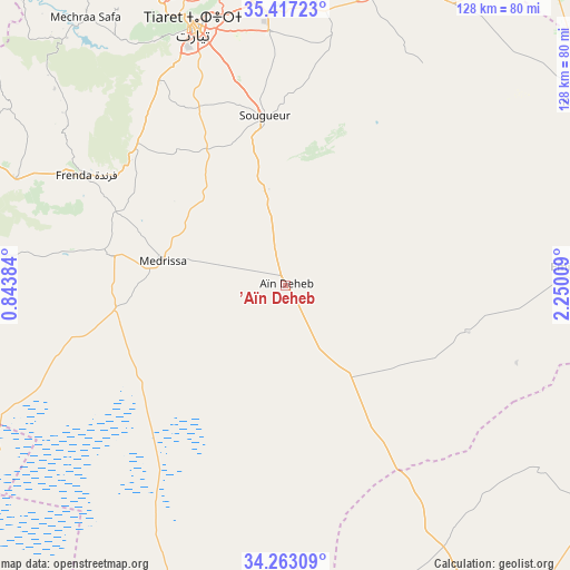
| Upper-left | 35.41723°, | 0.84384° |
| Center: | 34.84218°, | 1.54697° |
| Lower-right: | 34.26309°, | 2.25009° |
| Map W x H: | 128.3×128.3 km | = 79.7×79.7mi |
| max Lat: | 36.92917° ⇑81.8% North |
| ’Aïn Deheb: | 34.84218° |
| min Lat: | ⇓18.2% South 22.785° |
| min Long | ’Aïn Deheb | max Long |
| -8.14743° | 1.54697° | 8.46667° |
| W 25.6%⇐ | ⇒74.4% E |
Elevation
Elevation of ’Aïn Deheb is 1081 m = 3547 ft, and this is 642.5 m = 2108 ft above average elevation for this country.
| Max E: |
1392 m = 4567 ft | 6.6% |
| ’Aïn Deheb | 1081 m 3547 ft | |
| Avg. | 438.5 m = 1439 ft | |
Min E: |
5 m = 16 ft | 93.4% |
See also: Algeria elevation on elevation.city.
Geographical zone
’Aïn Deheb is located in North temperate zone (between Tropic of Cancer and the Arctic Circle). Distance of this Northern Tropic circle is 1268.2 km =788 mi to South.| Distance of | km | miles | from ’Aïn Deheb |
|---|---|---|---|
| North Pole | 6133 | 3810.9 | to North |
| Arctic Circle | 3527.1 | 2191.6 | to North |
| Tropic Cancer | 1268.2 | 788 | to South |
| Equator | 3874.1 | 2407.3 | to South |


Nearby cities:
15 places around ’Aïn Deheb: (largest is in red/bold)
• Aflou
95.7 km =59.5 mi,  147°
147°
• Ammi Moussa
120.7 km =75 mi,  340°
340°
• Charef
116.7 km =72.5 mi,  102°
102°
• Djebilet Rosfa
65 km =40.4 mi,  272°
272°
• El Idrissia
100 km =62.1 mi,  116°
116°
• Frenda
51.7 km =32.1 mi,  298°
298°
• Ksar Chellala
81.4 km =50.6 mi,  59°
59°
• Lardjem
100.9 km =62.7 mi,  0°
0°
• Mehdia daira de meghila
68.2 km =42.4 mi,  16°
16°
• Oued el Abtal
103.7 km =64.4 mi,  311°
311°
• Smala
120.9 km =75.1 mi,  323°
323°
• Sougueur
38.5 km =23.9 mi,  353°
353°
• Tiaret
62.4 km =38.8 mi, 340°
• Tissemsilt
88.4 km =54.9 mi, 15°
• Zemoura
121.4 km =75.4 mi, 323°
Sources, notices
• [Note1] Compared only with cities in Algeria existing in our database
• [Src1] Map data: © OpenStreetMap contributors (CC-BY-SA)
• [Src2] Other city data from geonames.org with taken over terms of usage.
• [Src3] Geographical zone / Annual Mean Temperature by Robert A. Rohde @ Wikipedia
