Mascara geodata
Mascara is a seat of a first-order administrative division; located in Algeria in Africa/Algiers (GMT+1) time zone. With population of 150,000 people, there are 21 cities with bigger population in this country. Compared to other cities in Algeria, 69.8% of cities are located further ↑North; 86% of cities are located further →East and 66.7% of cities have lower elevation than Mascara. Note1


Mascara GPS coordinates[2]
35° 23' 47.904" North, 0° 8' 24.972" East
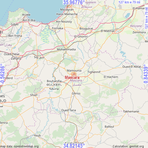
| Map corner | latitude | longitude |
|---|---|---|
| Upper-left | 35.96776°, | -0.56286° |
| Center: | 35.39664°, | 0.14027° |
| Lower-right: | 34.82145°, | 0.84339° |
| Map W x H: | 127.5×127.5 km | = 79.2×79.2mi |
| max Lat: | 36.92917° ⇑69.8% North |
| Mascara: | 35.39664° |
| min Lat: | ⇓30.2% South 22.785° |
| min Long | Mascara | max Long |
| -8.14743° | 0.14027° | 8.46667° |
| W 14%⇐ | ⇒86% E |
Elevation
Elevation of Mascara is 590 m = 1936 ft, and this is 151.5 m = 497 ft above average elevation for this country.
| Max E: |
1392 m = 4567 ft | 33.3% |
| Mascara | 590 m 1936 ft | |
| Avg. | 438.5 m = 1439 ft | |
Min E: |
5 m = 16 ft | 66.7% |
See also: Mascara elevation on elevation.city.
Geographical zone
Mascara is located in North temperate zone (between Tropic of Cancer and the Arctic Circle). Distance of this Northern Tropic circle is 1329.8 km =826.3 mi to South.| Distance of | km | miles | from Mascara |
|---|---|---|---|
| North Pole | 6071.3 | 3772.5 | to North |
| Arctic Circle | 3465.4 | 2153.3 | to North |
| Tropic Cancer | 1329.8 | 826.3 | to South |
| Equator | 3935.7 | 2445.5 | to South |


Nearby cities:
15 places around Mascara: (largest is in red/bold)
• Aïn el Bya
60.4 km =37.5 mi,  318°
318°
• Bir el Djir
71.7 km =44.6 mi,  300°
300°
• Bou Hanifia el Hamamat
19.5 km =12.1 mi,  242°
242°
• Mostaganem
59.6 km =37 mi,  355°
355°
• Oued el Abtal
50 km =31.1 mi,  82°
82°
• Relizane
53.4 km =33.2 mi,  44°
44°
• Rouachdia
63.7 km =39.6 mi,  57°
57°
• Saïda
63 km =39.1 mi,  179°
179°
• Sfizef
39.3 km =24.4 mi, 242°
• Sidi ech Chahmi
66.6 km =41.4 mi, 295°
• Sig
33.6 km =20.9 mi, 295°
• Smala
66 km =41 mi, 57°
• Zemoura
66.4 km =41.3 mi, 56°
• ’Aïn el Berd
59.3 km =36.8 mi,  266°
266°
• ’Aïn el Hadjar
71 km =44.1 mi, 179°
Sources, notices
• [Note1] Compared only with cities in Algeria existing in our database
• [Src1] Map data: © OpenStreetMap contributors (CC-BY-SA)
• [Src2] Other city data from geonames.org with taken over terms of usage.
• [Src3] Geographical zone / Annual Mean Temperature by Robert A. Rohde @ Wikipedia
