Bou Hanifia el Hamamat geodata
Bou Hanifia el Hamamat (Mascara) is a populated place; located in Algeria in Africa/Algiers (GMT+1) time zone. With population of 27,576 people, there are 188 cities with bigger population in this country. Compared to other cities in Algeria, 72.5% of cities are located further ↑North; 86.8% of cities are located further →East and 56.6% of cities have higher elevation than Bou Hanifia el Hamamat. Note1
Current local time in Bou Hanifia el Hamamat:
05:03 AM, WednesdayDifference from your time zone: hours


Bou Hanifia el Hamamat GPS coordinates[2]
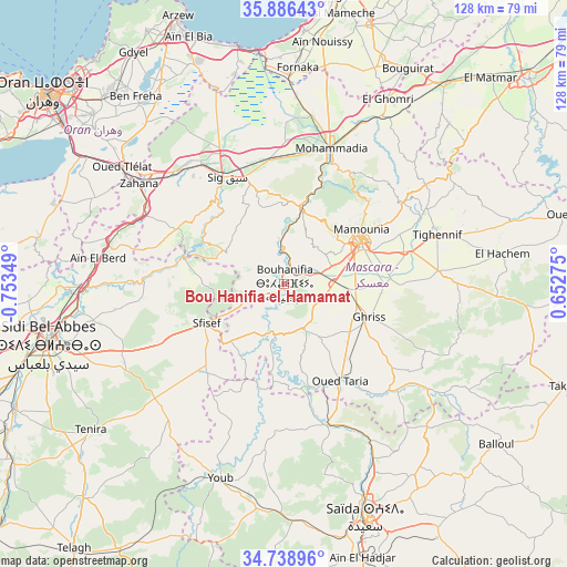
35° 18' 53.028" North, 0° 3' 1.332" West
| Map corner | latitude | longitude |
|---|---|---|
| Upper-left | 35.88643°, | -0.75349° |
| Center: | 35.31473°, | -0.05037° |
| Lower-right: | 34.73896°, | 0.65275° |
| Map W x H: | 127.6×127.6 km | = 79.3×79.3mi |
| max Lat: | 36.92917° ⇑72.5% North |
| Bou Hanifia el Hamamat: | 35.31473° |
| min Lat: | ⇓27.5% South 22.785° |
| min Long | Bou Hanifia el | max Long |
| -8.14743° | -0.05037° | 8.46667° |
| W 13.2%⇐ | ⇒86.8% E |
Elevation
Elevation of Bou Hanifia el Hamamat is 232 m = 761 ft, and this is 206.5 m = 677 ft below average elevation for this country.
| Max E: |
1392 m = 4567 ft | 56.6% |
| Avg. | 438.5 m = 1439 ft | |
| Bou Hanifia el Hamamat | 232 m = 761 ft | |
Min E: |
5 m = 16 ft | 43.4% |
See also: Algeria elevation on elevation.city.
Geographical zone
Bou Hanifia el Hamamat is located in North temperate zone (between Tropic of Cancer and the Arctic Circle). Distance of this Northern Tropic circle is 1320.7 km =820.6 mi to South.| Distance of | km | miles | from Bou Hanifia el Hamamat |
|---|---|---|---|
| North Pole | 6080.4 | 3778.2 | to North |
| Arctic Circle | 3474.5 | 2159 | to North |
| Tropic Cancer | 1320.7 | 820.6 | to South |
| Equator | 3926.6 | 2439.9 | to South |


Nearby cities:
15 places around Bou Hanifia el Hamamat: (largest is in red/bold)
• Aïn el Bya
59 km =36.7 mi,  337°
337°
• Bir el Djir
63.5 km =39.5 mi,  315°
315°
• Es Senia
63.8 km =39.6 mi,  305°
305°
• Mascara
19.5 km =12.1 mi,  62°
62°
• Mostaganem
69.7 km =43.3 mi,  10°
10°
• Oran
68.1 km =42.3 mi, 308°
• Oued el Abtal
68.7 km =42.7 mi,  76°
76°
• Relizane
72.2 km =44.9 mi,  49°
49°
• Saïda
56.9 km =35.4 mi,  161°
161°
• Sfizef
19.7 km =12.2 mi,  243°
243°
• Sidi Bel Abbès
54.5 km =33.9 mi,  255°
255°
• Sidi ech Chahmi
57.3 km =35.6 mi, 311°
• Sig
27.1 km =16.8 mi,  331°
331°
• ’Aïn el Berd
42.3 km =26.3 mi,  277°
277°
• ’Aïn el Hadjar
64.4 km =40 mi, 163°
Sources, notices
• [Note1] Compared only with cities in Algeria existing in our database
• [Src1] Map data: © OpenStreetMap contributors (CC-BY-SA)
• [Src2] Other city data from geonames.org with taken over terms of usage.
• [Src3] Geographical zone / Annual Mean Temperature by Robert A. Rohde @ Wikipedia
