Drean geodata
Drean (Annaba) is a populated place; located in Algeria in Africa/Algiers (GMT+1) time zone. With population of 55,147 people, there are 86 cities with bigger population in this country. Compared to other cities in Algeria, 84.9% of cities are located further ↓South; 95.3% of cities are located further ←West and 94.2% of cities have higher elevation than Drean. Note1


Drean GPS coordinates[2]
36° 41' 5.352" North, 7° 45' 3.996" East
| Map corner | latitude | longitude |
|---|---|---|
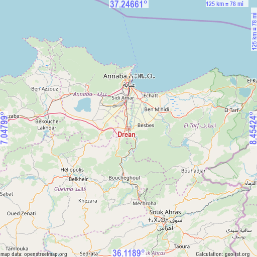
| Upper-left | 37.24661°, | 7.04799° |
| Center: | 36.68482°, | 7.75111° |
| Lower-right: | 36.1189°, | 8.45424° |
| Map W x H: | 125.4×125.4 km | = 77.9×77.9mi |
| max Lat: | 36.92917° ⇑15.1% North |
| Drean: | 36.68482° |
| min Lat: | ⇓84.9% South 22.785° |
| min Long | Drean | max Long |
| -8.14743° | 7.75111° | 8.46667° |
| W 95.3%⇐ | ⇒4.7% E |
Elevation
Elevation of Drean is 24 m = 79 ft, and this is 414.5 m = 1360 ft below average elevation for this country.
| Max E: |
1392 m = 4567 ft | 94.2% |
| Avg. | 438.5 m = 1439 ft | |
| Drean | 24 m = 79 ft | |
Min E: |
5 m = 16 ft | 5.8% |
See also: Drean elevation on elevation.city.
Geographical zone
Drean is located in North temperate zone (between Tropic of Cancer and the Arctic Circle). Distance of this Northern Tropic circle is 1473.1 km =915.3 mi to South.| Distance of | km | miles | from Drean |
|---|---|---|---|
| North Pole | 5928.1 | 3683.5 | to North |
| Arctic Circle | 3322.2 | 2064.3 | to North |
| Tropic Cancer | 1473.1 | 915.3 | to South |
| Equator | 4079 | 2534.6 | to South |


Nearby cities:
15 places around Drean: (largest is in red/bold)
• Annaba
24 km =14.9 mi,  3°
3°
• Azzaba
57.9 km =36 mi,  276°
276°
• Ben Mehidi
16.7 km =10.4 mi,  55°
55°
• Berrahal
31.4 km =19.5 mi,  302°
302°
• Besbes
8.8 km =5.5 mi,  77°
77°
• Boumahra Ahmed
32.9 km =20.4 mi,  220°
220°
• El Hadjar
13.3 km =8.3 mi,  354°
354°
• El Kala
65.9 km =40.9 mi,  69°
69°
• El Tarf
51 km =31.7 mi, 79°
• Guelma
38.1 km =23.7 mi,  229°
229°
• Héliopolis
34.1 km =21.2 mi, 233°
• Sedrata
64.8 km =40.3 mi,  197°
197°
• Skikda
77.9 km =48.4 mi,  285°
285°
• Souk Ahras
47.8 km =29.7 mi,  158°
158°
• ’Aïn Abid
88.1 km =54.7 mi,  235°
235°
Sources, notices
• [Note1] Compared only with cities in Algeria existing in our database
• [Src1] Map data: © OpenStreetMap contributors (CC-BY-SA)
• [Src2] Other city data from geonames.org with taken over terms of usage.
• [Src3] Geographical zone / Annual Mean Temperature by Robert A. Rohde @ Wikipedia
