Farshūţ geodata
Farshūţ (Qena) is a populated place; located in Egypt in Africa/Cairo (GMT+2) time zone. With population of 53,851 people, there are 81 cities with bigger population in this country. Compared to other cities in Egypt, 92.8% of cities are located further ↑North; 78.3% of cities are located further ←West and 89.9% of cities have lower elevation than Farshūţ. Note1


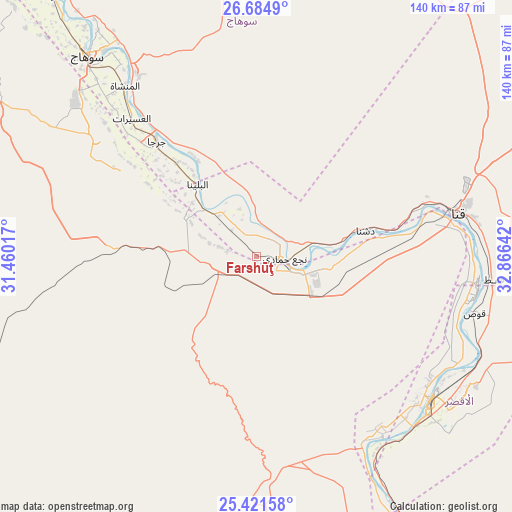
Farshūţ GPS coordinates[2]
26° 3' 17.784" North, 32° 9' 47.844" East
| Map corner | latitude | longitude |
|---|---|---|
| Upper-left | 26.6849°, | 31.46017° |
| Center: | 26.05494°, | 32.16329° |
| Lower-right: | 25.42158°, | 32.86642° |
| Map W x H: | 140.5×140.5 km | = 87.3×87.3mi |
| max Lat: | 31.5084° ⇑92.8% North |
| Farshūţ: | 26.05494° |
| min Lat: | ⇓7.2% South 22.3457° |
| min Long | Farshūţ | max Long |
| 25.51965° | 32.16329° | 34.89572° |
| W 78.3%⇐ | ⇒21.7% E |
Elevation
Elevation of Farshūţ is 78 m = 256 ft, and this is 34.5 m = 113 ft above average elevation for this country.
| Max E: |
1565 m = 5135 ft | 10.1% |
| Farshūţ | 78 m 256 ft | |
| Avg. | 43.5 m = 143 ft | |
Min E: |
-15 m = -49 ft | 89.9% |
See also: Farshūţ elevation on elevation.city.
Geographical zone
Farshūţ is located in North temperate zone (between Tropic of Cancer and the Arctic Circle). Distance of this Northern Tropic circle is 291.1 km =180.9 mi to South.| Distance of | km | miles | from Farshūţ |
|---|---|---|---|
| North Pole | 7110 | 4417.9 | to North |
| Arctic Circle | 4504.1 | 2798.7 | to North |
| Tropic Cancer | 291.1 | 180.9 | to South |
| Equator | 2897 | 1800.1 | to South |


Nearby cities:
15 places around Farshūţ: (largest is in red/bold)
• Abū Tīj
138.4 km =86 mi,  322°
322°
• Akhmīm
70.1 km =43.6 mi, 323°
• Al Badārī
128.1 km =79.6 mi, 324°
• Al Balyanā
25.7 km =16 mi, 321°
• Al Manshāh
59.1 km =36.7 mi, 322°
• Dishnā
32.2 km =20 mi,  76°
76°
• Isnā
93.3 km =58 mi,  155°
155°
• Jirjā
41.6 km =25.8 mi, 319°
• Juhaynah
95.5 km =59.3 mi, 316°
• Kousa
61.9 km =38.5 mi,  104°
104°
• Luxor
62.1 km =38.6 mi,  129°
129°
• Naja' Ḥammādī
7.8 km =4.8 mi,  94°
94°
• Qinā
57.5 km =35.7 mi, 77°
• Sohag
72.8 km =45.2 mi, 320°
• Ţahţā
103.2 km =64.1 mi, 320°
Sources, notices
• [Note1] Compared only with cities in Egypt existing in our database
• [Src1] Map data: © OpenStreetMap contributors (CC-BY-SA)
• [Src2] Other city data from geonames.org with taken over terms of usage.
• [Src3] Geographical zone / Annual Mean Temperature by Robert A. Rohde @ Wikipedia
