Naja' Ḥammādī geodata
Naja' Ḥammādī (Qena) is a populated place; located in Egypt in Africa/Cairo (GMT+2) time zone. With population of 41,184 people, there are 102 cities with bigger population in this country. Compared to other cities in Egypt, 93.5% of cities are located further ↑North; 79% of cities are located further ←West and 89.9% of cities have lower elevation than Naja' Ḥammādī. Note1


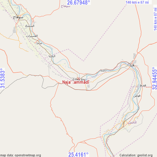
Naja' Ḥammādī GPS coordinates[2]
26° 2' 58.164" North, 32° 14' 29.112" East
| Map corner | latitude | longitude |
|---|---|---|
| Upper-left | 26.67948°, | 31.5383° |
| Center: | 26.04949°, | 32.24142° |
| Lower-right: | 25.4161°, | 32.94455° |
| Map W x H: | 140.5×140.5 km | = 87.3×87.3mi |
| max Lat: | 31.5084° ⇑93.5% North |
| Naja' Ḥammādī: | 26.04949° |
| min Lat: | ⇓6.5% South 22.3457° |
| min Long | Naja' Ḥammād | max Long |
| 25.51965° | 32.24142° | 34.89572° |
| W 79%⇐ | ⇒21% E |
Elevation
Elevation of Naja' Ḥammādī is 78 m = 256 ft, and this is 34.5 m = 113 ft above average elevation for this country.
| Max E: |
1565 m = 5135 ft | 10.1% |
| Naja' Ḥammādī | 78 m 256 ft | |
| Avg. | 43.5 m = 143 ft | |
Min E: |
-15 m = -49 ft | 89.9% |
See also: Naja' Ḥammādī elevation on elevation.city.
Geographical zone
Naja' Ḥammādī is located in North temperate zone (between Tropic of Cancer and the Arctic Circle). Distance of this Northern Tropic circle is 290.5 km =180.5 mi to South.| Distance of | km | miles | from Naja' Ḥammādī |
|---|---|---|---|
| North Pole | 7110.6 | 4418.3 | to North |
| Arctic Circle | 4504.7 | 2799.1 | to North |
| Tropic Cancer | 290.5 | 180.5 | to South |
| Equator | 2896.4 | 1799.7 | to South |


Nearby cities:
15 places around Naja' Ḥammādī: (largest is in red/bold)
• Akhmīm
75.5 km =46.9 mi,  319°
319°
• Al Badārī
133.2 km =82.8 mi, 321°
• Al Balyanā
31.5 km =19.6 mi,  311°
311°
• Al Manshāh
64.5 km =40.1 mi, 317°
• Dishnā
24.9 km =15.5 mi,  70°
70°
• Farshūţ
7.8 km =4.8 mi,  274°
274°
• Idfū
135 km =83.9 mi,  151°
151°
• Isnā
89.7 km =55.7 mi,  159°
159°
• Jirjā
47.4 km =29.5 mi, 312°
• Juhaynah
101.5 km =63.1 mi, 313°
• Kousa
54.2 km =33.7 mi,  105°
105°
• Luxor
55.9 km =34.7 mi,  134°
134°
• Qinā
50.1 km =31.1 mi,  75°
75°
• Sohag
78.4 km =48.7 mi, 316°
• Ţahţā
108.7 km =67.5 mi, 317°
In other languages:
- In Spanish: Nag Hammadi
- In France: Nag Hammadi
- In German: Nag Hammadi
- In Italian: Nag Hammâdi
Sources, notices
• [Note1] Compared only with cities in Egypt existing in our database
• [Src1] Map data: © OpenStreetMap contributors (CC-BY-SA)
• [Src2] Other city data from geonames.org with taken over terms of usage.
• [Src3] Geographical zone / Annual Mean Temperature by Robert A. Rohde @ Wikipedia
