Al Manshāh geodata
Al Manshāh (Sohag) is a populated place; located in Egypt in Africa/Cairo (GMT+2) time zone. With population of 61,134 people, there are 69 cities with bigger population in this country. Compared to other cities in Egypt, 88.4% of cities are located further ↑North; 72.5% of cities are located further ←West and 86.2% of cities have lower elevation than Al Manshāh. Note1


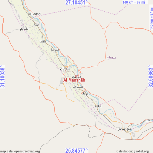
Al Manshāh GPS coordinates[2]
26° 28' 36.696" North, 31° 48' 12.6" East
| Map corner | latitude | longitude |
|---|---|---|
| Upper-left | 27.10451°, | 31.10038° |
| Center: | 26.47686°, | 31.8035° |
| Lower-right: | 25.84577°, | 32.50663° |
| Map W x H: | 140×140 km | = 87×87mi |
| max Lat: | 31.5084° ⇑88.4% North |
| Al Manshāh: | 26.47686° |
| min Lat: | ⇓11.6% South 22.3457° |
| min Long | Al Manshāh | max Long |
| 25.51965° | 31.8035° | 34.89572° |
| W 72.5%⇐ | ⇒27.5% E |
Elevation
Elevation of Al Manshāh is 72 m = 236 ft, and this is 28.5 m = 94 ft above average elevation for this country.
| Max E: |
1565 m = 5135 ft | 13.8% |
| Al Manshāh | 72 m 236 ft | |
| Avg. | 43.5 m = 143 ft | |
Min E: |
-15 m = -49 ft | 86.2% |
See also: Al Manshāh elevation on elevation.city.
Geographical zone
Al Manshāh is located in North temperate zone (between Tropic of Cancer and the Arctic Circle). Distance of this Northern Tropic circle is 338 km =210 mi to South.| Distance of | km | miles | from Al Manshāh |
|---|---|---|---|
| North Pole | 7063.1 | 4388.8 | to North |
| Arctic Circle | 4457.2 | 2769.6 | to North |
| Tropic Cancer | 338 | 210 | to South |
| Equator | 2944 | 1829.3 | to South |


Nearby cities:
15 places around Al Manshāh: (largest is in red/bold)
• Abnūb
109.3 km =67.9 mi,  323°
323°
• Abū Tīj
79.3 km =49.3 mi, 322°
• Akhmīm
11.1 km =6.9 mi,  328°
328°
• Al Badārī
69.1 km =42.9 mi, 326°
• Al Balyanā
33.4 km =20.8 mi,  143°
143°
• Asyūţ
99.6 km =61.9 mi, 321°
• Dishnā
77.6 km =48.2 mi,  120°
120°
• Farshūţ
59.1 km =36.7 mi, 142°
• Jirjā
17.7 km =11 mi,  150°
150°
• Juhaynah
37.4 km =23.2 mi,  305°
305°
• Kousa
114.3 km =71 mi, 123°
• Naja' Ḥammādī
64.5 km =40.1 mi, 137°
• Qinā
98.4 km =61.1 mi,  110°
110°
• Sohag
14 km =8.7 mi, 309°
• Ţahţā
44.2 km =27.5 mi, 317°
Sources, notices
• [Note1] Compared only with cities in Egypt existing in our database
• [Src1] Map data: © OpenStreetMap contributors (CC-BY-SA)
• [Src2] Other city data from geonames.org with taken over terms of usage.
• [Src3] Geographical zone / Annual Mean Temperature by Robert A. Rohde @ Wikipedia
