Jirjā geodata
Jirjā (Sohag) is a populated place; located in Egypt in Africa/Cairo (GMT+2) time zone. With population of 128,250 people, there are 32 cities with bigger population in this country. Compared to other cities in Egypt, 89.1% of cities are located further ↑North; 75.4% of cities are located further ←West and 85.5% of cities have lower elevation than Jirjā. Note1


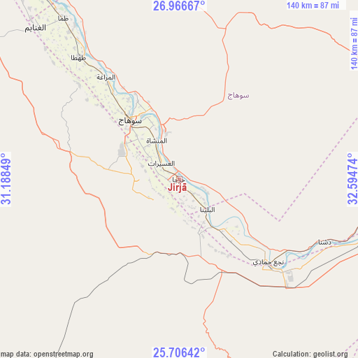
Jirjā GPS coordinates[2]
26° 20' 17.736" North, 31° 53' 29.796" East
| Map corner | latitude | longitude |
|---|---|---|
| Upper-left | 26.96667°, | 31.18849° |
| Center: | 26.33826°, | 31.89161° |
| Lower-right: | 25.70642°, | 32.59474° |
| Map W x H: | 140.1×140.1 km | = 87.1×87.1mi |
| max Lat: | 31.5084° ⇑89.1% North |
| Jirjā: | 26.33826° |
| min Lat: | ⇓10.9% South 22.3457° |
| min Long | Jirjā | max Long |
| 25.51965° | 31.89161° | 34.89572° |
| W 75.4%⇐ | ⇒24.6% E |
Elevation
Elevation of Jirjā is 70 m = 230 ft, and this is 26.5 m = 87 ft above average elevation for this country.
| Max E: |
1565 m = 5135 ft | 14.5% |
| Jirjā | 70 m 230 ft | |
| Avg. | 43.5 m = 143 ft | |
Min E: |
-15 m = -49 ft | 85.5% |
See also: Jirjā elevation on elevation.city.
Geographical zone
Jirjā is located in North temperate zone (between Tropic of Cancer and the Arctic Circle). Distance of this Northern Tropic circle is 322.6 km =200.5 mi to South.| Distance of | km | miles | from Jirjā |
|---|---|---|---|
| North Pole | 7078.5 | 4398.4 | to North |
| Arctic Circle | 4472.6 | 2779.1 | to North |
| Tropic Cancer | 322.6 | 200.5 | to South |
| Equator | 2928.5 | 1819.7 | to South |


Nearby cities:
15 places around Jirjā: (largest is in red/bold)
• Abū Tīj
96.9 km =60.2 mi,  324°
324°
• Akhmīm
28.9 km =18 mi,  329°
329°
• Al Badārī
86.8 km =53.9 mi, 326°
• Al Balyanā
16 km =9.9 mi,  135°
135°
• Al Manshāh
17.7 km =11 mi, 330°
• Asyūţ
117.1 km =72.8 mi, 323°
• Dishnā
62.9 km =39.1 mi,  112°
112°
• Farshūţ
41.6 km =25.8 mi, 139°
• Juhaynah
54.1 km =33.6 mi,  313°
313°
• Kousa
98.9 km =61.5 mi,  118°
118°
• Luxor
103.3 km =64.2 mi,  133°
133°
• Naja' Ḥammādī
47.4 km =29.5 mi, 132°
• Qinā
85.5 km =53.1 mi,  103°
103°
• Sohag
31.2 km =19.4 mi, 321°
• Ţahţā
61.6 km =38.3 mi, 321°
Sources, notices
• [Note1] Compared only with cities in Egypt existing in our database
• [Src1] Map data: © OpenStreetMap contributors (CC-BY-SA)
• [Src2] Other city data from geonames.org with taken over terms of usage.
• [Src3] Geographical zone / Annual Mean Temperature by Robert A. Rohde @ Wikipedia
