Mersa Matruh geodata
Mersa Matruh (Matruh) is a seat of a first-order administrative division; located in Egypt in Africa/Cairo (GMT+2) time zone. With population of 62,042 people, there are 66 cities with bigger population in this country. Compared to other cities in Egypt, 97.8% of cities are located further ↓South; 99.3% of cities are located further →East and 90.6% of cities have higher elevation than Mersa Matruh. Note1


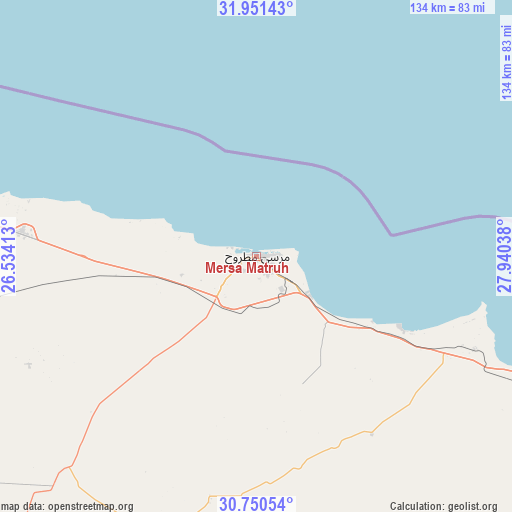
Mersa Matruh GPS coordinates[2]
31° 21' 10.44" North, 27° 14' 14.1" East
| Map corner | latitude | longitude |
|---|---|---|
| Upper-left | 31.95143°, | 26.53413° |
| Center: | 31.3529°, | 27.23725° |
| Lower-right: | 30.75054°, | 27.94038° |
| Map W x H: | 133.5×133.5 km | = 83×83mi |
| max Lat: | 31.5084° ⇑2.2% North |
| Mersa Matruh: | 31.3529° |
| min Lat: | ⇓97.8% South 22.3457° |
| min Long | Mersa Matruh | max Long |
| 25.51965° | 27.23725° | 34.89572° |
| W 0.7%⇐ | ⇒99.3% E |
Elevation
Elevation of Mersa Matruh is 7 m = 23 ft, and this is 36.5 m = 120 ft below average elevation for this country.
| Max E: |
1565 m = 5135 ft | 90.6% |
| Avg. | 43.5 m = 143 ft | |
| Mersa Matruh | 7 m = 23 ft | |
Min E: |
-15 m = -49 ft | 9.4% |
See also: Mersa Matruh elevation on elevation.city.
Geographical zone
Mersa Matruh is located in North temperate zone (between Tropic of Cancer and the Arctic Circle). Distance of this Northern Tropic circle is 880.2 km =546.9 mi to South.| Distance of | km | miles | from Mersa Matruh |
|---|---|---|---|
| North Pole | 6520.9 | 4051.9 | to North |
| Arctic Circle | 3915.1 | 2432.7 | to North |
| Tropic Cancer | 880.2 | 546.9 | to South |
| Equator | 3486.1 | 2166.2 | to South |


Nearby cities:
15 places around Mersa Matruh: (largest is in red/bold)
• Abū al Maţāmīr
283.8 km =176.3 mi,  99°
99°
• Ad Dilinjāt
319.4 km =198.5 mi, 100°
• Al ‘Alamayn
173.6 km =107.9 mi,  109°
109°
• Alexandria
255.1 km =158.5 mi,  93°
93°
• Beheira
310.6 km =193 mi, 107°
• Damanhūr
309.3 km =192.2 mi, 96°
• Disūq
325.1 km =202 mi, 94°
• Fuwwah
315.1 km =195.8 mi, 93°
• Idkū
290.7 km =180.6 mi, 90°
• Kafr ad Dawwār
276 km =171.5 mi, 95°
• Kawm Ḩamādah
336.3 km =209 mi, 101°
• Munshāt ‘Alī Āghā
330 km =205.1 mi, 93°
• Rosetta
301.9 km =187.6 mi, 89°
• Siwa Oasis
290.4 km =180.4 mi,  214°
214°
• Ḩawsh ‘Īsá
294.6 km =183.1 mi, 99°
Sources, notices
• [Note1] Compared only with cities in Egypt existing in our database
• [Src1] Map data: © OpenStreetMap contributors (CC-BY-SA)
• [Src2] Other city data from geonames.org with taken over terms of usage.
• [Src3] Geographical zone / Annual Mean Temperature by Robert A. Rohde @ Wikipedia
