Al ‘Alamayn geodata
Al ‘Alamayn (Matruh) is a populated place; located in Egypt in Africa/Cairo (GMT+2) time zone. With population of 7,400 people, there are 126 cities with bigger population in this country. Compared to other cities in Egypt, 73.2% of cities are located further ↓South; 97.1% of cities are located further →East and 90.6% of cities have higher elevation than Al ‘Alamayn. Note1


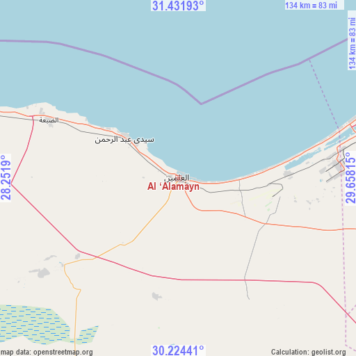
Al ‘Alamayn GPS coordinates[2]
30° 49' 48.252" North, 28° 57' 18.072" East
| Map corner | latitude | longitude |
|---|---|---|
| Upper-left | 31.43193°, | 28.2519° |
| Center: | 30.83007°, | 28.95502° |
| Lower-right: | 30.22441°, | 29.65815° |
| Map W x H: | 134.3×134.3 km | = 83.5×83.5mi |
| max Lat: | 31.5084° ⇑26.8% North |
| Al ‘Alamayn: | 30.83007° |
| min Lat: | ⇓73.2% South 22.3457° |
| min Long | Al ‘Alamayn | max Long |
| 25.51965° | 28.95502° | 34.89572° |
| W 2.9%⇐ | ⇒97.1% E |
Elevation
Elevation of Al ‘Alamayn is 7 m = 23 ft, and this is 36.5 m = 120 ft below average elevation for this country.
| Max E: |
1565 m = 5135 ft | 90.6% |
| Avg. | 43.5 m = 143 ft | |
| Al ‘Alamayn | 7 m = 23 ft | |
Min E: |
-15 m = -49 ft | 9.4% |
See also: Egypt elevation on elevation.city.
Geographical zone
Al ‘Alamayn is located in North temperate zone (between Tropic of Cancer and the Arctic Circle). Distance of this Northern Tropic circle is 822.1 km =510.8 mi to South.| Distance of | km | miles | from Al ‘Alamayn |
|---|---|---|---|
| North Pole | 6579.1 | 4088.1 | to North |
| Arctic Circle | 3973.2 | 2468.8 | to North |
| Tropic Cancer | 822.1 | 510.8 | to South |
| Equator | 3428 | 2130.1 | to South |


Nearby cities:
15 places around Al ‘Alamayn: (largest is in red/bold)
• Abū al Maţāmīr
116.7 km =72.5 mi,  85°
85°
• Ad Dilinjāt
150.9 km =93.8 mi, 90°
• Alexandria
100.5 km =62.4 mi,  65°
65°
• Basyūn
177.7 km =110.4 mi, 86°
• Beheira
137.3 km =85.3 mi,  104°
104°
• Damanhūr
146.1 km =90.8 mi,  81°
81°
• Disūq
164.8 km =102.4 mi, 78°
• Fuwwah
157.5 km =97.9 mi, 74°
• Idkū
138.5 km =86.1 mi, 67°
• Kafr ad Dawwār
117 km =72.7 mi, 73°
• Kawm Ḩamādah
166.8 km =103.6 mi, 92°
• Mersa Matruh
173.6 km =107.9 mi,  289°
289°
• Munshāt ‘Alī Āghā
170.4 km =105.9 mi, 77°
• Rosetta
152.9 km =95 mi, 65°
• Ḩawsh ‘Īsá
127.8 km =79.4 mi, 85°
In other languages:
- In Spanish: El Alamein
- In France: El-Alamein
- In German: El-Alamein
- In Italian: El Alamein
- In Russian: Эль-Аламейн
- In Chinese: 阿莱曼
Sources, notices
• [Note1] Compared only with cities in Egypt existing in our database
• [Src1] Map data: © OpenStreetMap contributors (CC-BY-SA)
• [Src2] Other city data from geonames.org with taken over terms of usage.
• [Src3] Geographical zone / Annual Mean Temperature by Robert A. Rohde @ Wikipedia
