Ismailia geodata
Ismailia is a seat of a first-order administrative division; located in Egypt in Africa/Cairo (GMT+2) time zone. With population of 284,813 people, there are 12 cities with bigger population in this country. Compared to other cities in Egypt, 62.3% of cities are located further ↓South; 79.7% of cities are located further ←West and 65.2% of cities have higher elevation than Ismailia. Note1


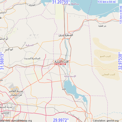
Ismailia GPS coordinates[2]
30° 36' 15.372" North, 32° 16' 20.1" East
| Map corner | latitude | longitude |
|---|---|---|
| Upper-left | 31.20755°, | 31.56913° |
| Center: | 30.60427°, | 32.27225° |
| Lower-right: | 29.9972°, | 32.97538° |
| Map W x H: | 134.6×134.6 km | = 83.6×83.6mi |
| max Lat: | 31.5084° ⇑37.7% North |
| Ismailia: | 30.60427° |
| min Lat: | ⇓62.3% South 22.3457° |
| min Long | Ismailia | max Long |
| 25.51965° | 32.27225° | 34.89572° |
| W 79.7%⇐ | ⇒20.3% E |
Elevation
Elevation of Ismailia is 14 m = 46 ft, and this is 29.5 m = 97 ft below average elevation for this country.
| Max E: |
1565 m = 5135 ft | 65.2% |
| Avg. | 43.5 m = 143 ft | |
| Ismailia | 14 m = 46 ft | |
Min E: |
-15 m = -49 ft | 34.8% |
See also: Ismailia elevation on elevation.city.
Geographical zone
Ismailia is located in North temperate zone (between Tropic of Cancer and the Arctic Circle). Distance of this Northern Tropic circle is 797 km =495.2 mi to South.| Distance of | km | miles | from Ismailia |
|---|---|---|---|
| North Pole | 6604.2 | 4103.7 | to North |
| Arctic Circle | 3998.3 | 2484.4 | to North |
| Tropic Cancer | 797 | 495.2 | to South |
| Equator | 3402.9 | 2114.5 | to South |


Nearby cities:
15 places around Ismailia: (largest is in red/bold)
• Abū Kabīr
59 km =36.7 mi,  283°
283°
• Al Ibrāhīmīyah
69 km =42.9 mi, 280°
• Al Jammālīyah
74.9 km =46.5 mi,  328°
328°
• Al Manzalah
69.5 km =43.2 mi, 332°
• Al Maţarīyah
68.3 km =42.4 mi,  340°
340°
• Al Qanāyāt
77.6 km =48.2 mi,  271°
271°
• Al Qurayn
51.4 km =31.9 mi, 271°
• At Tall al Kabīr
47.1 km =29.3 mi,  261°
261°
• Bilbays
71 km =44.1 mi,  253°
253°
• Fāqūs
47.5 km =29.5 mi,  286°
286°
• Hihyā
65.9 km =40.9 mi, 276°
• Kafr Şaqr
65.3 km =40.6 mi, 288°
• Port Said
72.5 km =45 mi,  0°
0°
• Suez
74.2 km =46.1 mi,  160°
160°
• Zagazig
73.7 km =45.8 mi, 268°
Sources, notices
• [Note1] Compared only with cities in Egypt existing in our database
• [Src1] Map data: © OpenStreetMap contributors (CC-BY-SA)
• [Src2] Other city data from geonames.org with taken over terms of usage.
• [Src3] Geographical zone / Annual Mean Temperature by Robert A. Rohde @ Wikipedia
