Zarza la Mayor geodata
Zarza la Mayor (Extremadura) is a seat of a third-order administrative division; located in Spain in Europe/Madrid (GMT+2) time zone. With population of 1,481 people, there are 2476 cities with bigger population in this country. Compared to other cities in Spain, 72% of cities are located further ↑North; 93.8% of cities are located further →East and 74.5% of cities have higher elevation than Zarza la Mayor. Note1
Administrative division(s):
- Level 1: Extremadura
- Level 2: Provincia de Cáceres
- Level 3: Zarza la Mayor


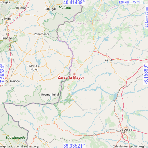
Zarza la Mayor GPS coordinates[2]
39° 52' 36.912" North, 6° 51' 43.596" West
| Map corner | latitude | longitude |
|---|---|---|
| Upper-left | 40.41439°, | -7.56524° |
| Center: | 39.87692°, | -6.86211° |
| Lower-right: | 39.33521°, | -6.15899° |
| Map W x H: | 120×120 km | = 74.6×74.6mi |
| max Lat: | 43.74134° ⇑72% North |
| Zarza la Mayor: | 39.87692° |
| min Lat: | ⇓28% South 27.64134° |
| min Long | Zarza la Mayor | max Long |
| -18.00367° | -6.86211° | 4.2899° |
| W 6.2%⇐ | ⇒93.8% E |
Elevation
Elevation of Zarza la Mayor is 305 m = 1001 ft, and this is 293 m = 961 ft below average elevation for this country.
| Max E: |
1682 m = 5518 ft | 74.5% |
| Avg. | 598 m = 1962 ft | |
| Zarza la Mayor | 305 m = 1001 ft | |
Min E: |
0 m = 0 ft | 25.5% |
See also: Spain elevation on elevation.city.
Geographical zone
Zarza la Mayor is located in North temperate zone (between Tropic of Cancer and the Arctic Circle). Distance of this Northern Tropic circle is 1828 km =1135.9 mi to South.| Distance of | km | miles | from Zarza la Mayor |
|---|---|---|---|
| North Pole | 5573.2 | 3463 | to North |
| Arctic Circle | 2967.3 | 1843.8 | to North |
| Tropic Cancer | 1828 | 1135.9 | to South |
| Equator | 4433.9 | 2755.1 | to South |


Nearby cities:
15 places around Zarza la Mayor: (largest is in red/bold)
• Acehuche
21.2 km =13.2 mi,  112°
112°
• Alcántara
17.7 km =11 mi,  186°
186°
• Cachorrilla
17 km =10.6 mi,  75°
75°
• Casas de Don Gómez
26.7 km =16.6 mi,  56°
56°
• Casillas de Coria
21.6 km =13.4 mi, 62°
• Ceclavín
9.7 km =6 mi,  128°
128°
• Cilleros
27.1 km =16.8 mi,  12°
12°
• Coria
30.2 km =18.8 mi,  66°
66°
• Huélaga
28.9 km =18 mi,  46°
46°
• Mata de Alcántara
18.1 km =11.2 mi,  168°
168°
• Moraleja
27.3 km =17 mi,  39°
39°
• Pescueza
19 km =11.8 mi, 76°
• Piedras Albas
11.7 km =7.3 mi,  207°
207°
• Portaje
26 km =16.2 mi, 79°
• Villa del Rey
24.4 km =15.2 mi, 171°
Sources, notices
• [Note1] Compared only with cities in Spain existing in our database
• [Src1] Map data: © OpenStreetMap contributors (CC-BY-SA)
• [Src2] Other city data from geonames.org with taken over terms of usage.
• [Src3] Geographical zone / Annual Mean Temperature by Robert A. Rohde @ Wikipedia
