Redován geodata
Redován (Valencia) is a seat of a third-order administrative division; located in Spain in Europe/Madrid (GMT+2) time zone. With population of 6,507 people, there are 1084 cities with bigger population in this country. Compared to other cities in Spain, 87.7% of cities are located further ↑North; 77.9% of cities are located further ←West and 94.7% of cities have higher elevation than Redován. Note1


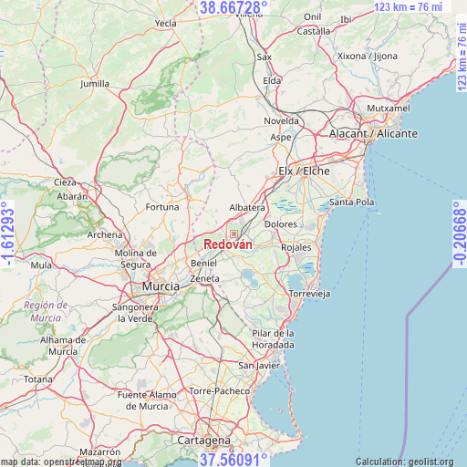
Redován GPS coordinates[2]
38° 6' 58.284" North, 0° 54' 35.316" West
| Map corner | latitude | longitude |
|---|---|---|
| Upper-left | 38.66728°, | -1.61293° |
| Center: | 38.11619°, | -0.90981° |
| Lower-right: | 37.56091°, | -0.20668° |
| Map W x H: | 123×123 km | = 76.4×76.4mi |
| max Lat: | 43.74134° ⇑87.7% North |
| Redován: | 38.11619° |
| min Lat: | ⇓12.3% South 27.64134° |
| min Long | Redován | max Long |
| -18.00367° | -0.90981° | 4.2899° |
| W 77.9%⇐ | ⇒22.1% E |
Elevation
Elevation of Redován is 26 m = 85 ft, and this is 572 m = 1877 ft below average elevation for this country.
| Max E: |
1682 m = 5518 ft | 94.7% |
| Avg. | 598 m = 1962 ft | |
| Redován | 26 m = 85 ft | |
Min E: |
0 m = 0 ft | 5.3% |
See also: Spain elevation on elevation.city.
Geographical zone
Redován is located in North temperate zone (between Tropic of Cancer and the Arctic Circle). Distance of this Northern Tropic circle is 1632.2 km =1014.2 mi to South.| Distance of | km | miles | from Redován |
|---|---|---|---|
| North Pole | 5768.9 | 3584.6 | to North |
| Arctic Circle | 3163.1 | 1965.5 | to North |
| Tropic Cancer | 1632.2 | 1014.2 | to South |
| Equator | 4238.1 | 2633.4 | to South |


Nearby cities:
15 places around Redován: (largest is in red/bold)
• Albatera
7.8 km =4.8 mi,  26°
26°
• Algorfa
10.5 km =6.5 mi,  108°
108°
• Almoradí
10.3 km =6.4 mi,  94°
94°
• Benejúzar
7.5 km =4.7 mi,  125°
125°
• Benferri
5.4 km =3.4 mi,  301°
301°
• Beniel
11.2 km =7 mi,  226°
226°
• Bigastro
6.1 km =3.8 mi,  170°
170°
• Callosa de Segura
2.9 km =1.8 mi,  70°
70°
• Catral
10.6 km =6.6 mi,  62°
62°
• Cox
3.4 km =2.1 mi, 34°
• Granja de Rocamora
4.2 km =2.6 mi,  21°
21°
• Jacarilla
7 km =4.3 mi,  148°
148°
• Orihuela
4.6 km =2.9 mi,  220°
220°
• Rafal
5.5 km =3.4 mi,  103°
103°
• San Isidro
8.8 km =5.5 mi,  44°
44°
Sources, notices
• [Note1] Compared only with cities in Spain existing in our database
• [Src1] Map data: © OpenStreetMap contributors (CC-BY-SA)
• [Src2] Other city data from geonames.org with taken over terms of usage.
• [Src3] Geographical zone / Annual Mean Temperature by Robert A. Rohde @ Wikipedia
