Pegalajar geodata
Pegalajar (Andalusia) is a seat of a third-order administrative division; located in Spain in Europe/Madrid (GMT+2) time zone. With population of 3,095 people, there are 1691 cities with bigger population in this country. Compared to other cities in Spain, 89.9% of cities are located further ↑North; 54.6% of cities are located further →East and 70.9% of cities have lower elevation than Pegalajar. Note1


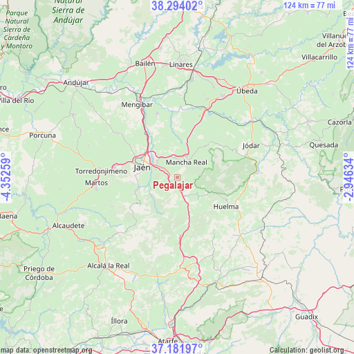
Pegalajar GPS coordinates[2]
37° 44' 24.288" North, 3° 38' 58.056" West
| Map corner | latitude | longitude |
|---|---|---|
| Upper-left | 38.29402°, | -4.35259° |
| Center: | 37.74008°, | -3.64946° |
| Lower-right: | 37.18197°, | -2.94634° |
| Map W x H: | 123.6×123.6 km | = 76.8×76.8mi |
| max Lat: | 43.74134° ⇑89.9% North |
| Pegalajar: | 37.74008° |
| min Lat: | ⇓10.1% South 27.64134° |
| min Long | Pegalajar | max Long |
| -18.00367° | -3.64946° | 4.2899° |
| W 45.4%⇐ | ⇒54.6% E |
Elevation
Elevation of Pegalajar is 821 m = 2694 ft, and this is 223 m = 732 ft above average elevation for this country.
| Max E: |
1682 m = 5518 ft | 29.1% |
| Pegalajar | 821 m 2694 ft | |
| Avg. | 598 m = 1962 ft | |
Min E: |
0 m = 0 ft | 70.9% |
See also: Spain elevation on elevation.city.
Geographical zone
Pegalajar is located in North temperate zone (between Tropic of Cancer and the Arctic Circle). Distance of this Northern Tropic circle is 1590.4 km =988.2 mi to South.| Distance of | km | miles | from Pegalajar |
|---|---|---|---|
| North Pole | 5810.8 | 3610.7 | to North |
| Arctic Circle | 3204.9 | 1991.4 | to North |
| Tropic Cancer | 1590.4 | 988.2 | to South |
| Equator | 4196.3 | 2607.5 | to South |


Nearby cities:
15 places around Pegalajar: (largest is in red/bold)
• Bélmez de la Moraleda
23.6 km =14.7 mi,  94°
94°
• Cambil
10 km =6.2 mi,  132°
132°
• Campillo de Arenas
20.6 km =12.8 mi,  176°
176°
• Huelma
19.6 km =12.2 mi,  121°
121°
• Jamilena
23.3 km =14.5 mi,  271°
271°
• Jaén
12.8 km =8 mi,  284°
284°
• Jimena
18.9 km =11.7 mi,  53°
53°
• La Guardia de Jaén
3.9 km =2.4 mi, 274°
• Los Villares
15.8 km =9.8 mi,  250°
250°
• Mancha Real
6.1 km =3.8 mi,  32°
32°
• Montejicar
22.6 km =14 mi,  145°
145°
• Noalejo
23.3 km =14.5 mi, 181°
• Torre del Campo
22 km =13.7 mi, 278°
• Torres
13.3 km =8.3 mi,  67°
67°
• Valdepeñas de Jaén
22.2 km =13.8 mi,  220°
220°
Sources, notices
• [Note1] Compared only with cities in Spain existing in our database
• [Src1] Map data: © OpenStreetMap contributors (CC-BY-SA)
• [Src2] Other city data from geonames.org with taken over terms of usage.
• [Src3] Geographical zone / Annual Mean Temperature by Robert A. Rohde @ Wikipedia
