Bélmez de la Moraleda geodata
Bélmez de la Moraleda (Andalusia) is a seat of a third-order administrative division; located in Spain in Europe/Madrid (GMT+2) time zone. With population of 1,859 people, there are 2251 cities with bigger population in this country. Compared to other cities in Spain, 90% of cities are located further ↑North; 50.5% of cities are located further →East and 76.8% of cities have lower elevation than Bélmez de la Moraleda. Note1
Administrative division(s):
- Level 1: Andalusia
- Level 2: Provincia de Jaén
- Level 3: Bélmez de la Moraleda
Current local time in Bélmez de la Moraleda:
10:46 PM, ThursdayDifference from your time zone: hours


Bélmez de la Moraleda GPS coordinates[2]
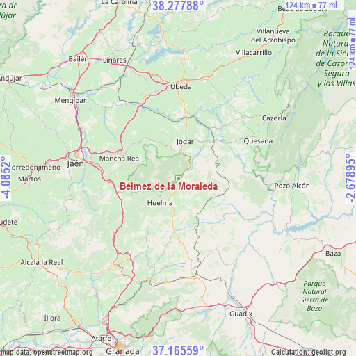
37° 43' 25.752" North, 3° 22' 55.452" West
| Map corner | latitude | longitude |
|---|---|---|
| Upper-left | 38.27788°, | -4.0852° |
| Center: | 37.72382°, | -3.38207° |
| Lower-right: | 37.16559°, | -2.67895° |
| Map W x H: | 123.7×123.7 km | = 76.9×76.9mi |
| max Lat: | 43.74134° ⇑90% North |
| Bélmez de la Moraleda: | 37.72382° |
| min Lat: | ⇓10% South 27.64134° |
| min Long | Bélmez de la M | max Long |
| -18.00367° | -3.38207° | 4.2899° |
| W 49.5%⇐ | ⇒50.5% E |
Elevation
Elevation of Bélmez de la Moraleda is 869 m = 2851 ft, and this is 271 m = 889 ft above average elevation for this country.
| Max E: |
1682 m = 5518 ft | 23.2% |
| Bélmez de la Moraleda | 869 m 2851 ft | |
| Avg. | 598 m = 1962 ft | |
Min E: |
0 m = 0 ft | 76.8% |
See also: Spain elevation on elevation.city.
Geographical zone
Bélmez de la Moraleda is located in North temperate zone (between Tropic of Cancer and the Arctic Circle). Distance of this Northern Tropic circle is 1588.6 km =987.1 mi to South.| Distance of | km | miles | from Bélmez de la Moraleda |
|---|---|---|---|
| North Pole | 5812.6 | 3611.8 | to North |
| Arctic Circle | 3206.7 | 1992.6 | to North |
| Tropic Cancer | 1588.6 | 987.1 | to South |
| Equator | 4194.5 | 2606.3 | to South |


Nearby cities:
15 places around Bélmez de la Moraleda: (largest is in red/bold)
• Alamedilla
20 km =12.4 mi,  141°
141°
• Alicún de Ortega
25.1 km =15.6 mi,  120°
120°
• Cabra del Santo Cristo
8.6 km =5.3 mi,  105°
105°
• Cambil
16.9 km =10.5 mi,  252°
252°
• Guadahortuna
18.6 km =11.6 mi,  184°
184°
• Hornos
24.8 km =15.4 mi,  43°
43°
• Huelma
10.9 km =6.8 mi,  219°
219°
• Jimena
15.5 km =9.6 mi,  327°
327°
• Jódar
13.2 km =8.2 mi,  11°
11°
• Larva
16.3 km =10.1 mi,  75°
75°
• Mancha Real
21.4 km =13.3 mi,  288°
288°
• Montejicar
20 km =12.4 mi,  212°
212°
• Pegalajar
23.6 km =14.7 mi,  274°
274°
• Torre-Cardela
24.5 km =15.2 mi,  174°
174°
• Torres
13.1 km =8.1 mi,  301°
301°
Sources, notices
• [Note1] Compared only with cities in Spain existing in our database
• [Src1] Map data: © OpenStreetMap contributors (CC-BY-SA)
• [Src2] Other city data from geonames.org with taken over terms of usage.
• [Src3] Geographical zone / Annual Mean Temperature by Robert A. Rohde @ Wikipedia
