Olías del Rey geodata
Olías del Rey (Castille-La Mancha) is a seat of a third-order administrative division; located in Spain in Europe/Madrid (GMT+2) time zone. With population of 5,336 people, there are 1244 cities with bigger population in this country. Compared to other cities in Spain, 71.1% of cities are located further ↑North; 59.4% of cities are located further →East and 55.2% of cities have higher elevation than Olías del Rey. Note1
Administrative division(s):
- Level 1: Castille-La Mancha
- Level 2: Province of Toledo
- Level 3: Olías del Rey


Olías del Rey GPS coordinates[2]
39° 56' 39.696" North, 3° 59' 12.624" West
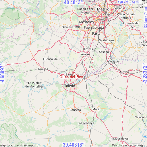
| Map corner | latitude | longitude |
|---|---|---|
| Upper-left | 40.4813°, | -4.68997° |
| Center: | 39.94436°, | -3.98684° |
| Lower-right: | 39.40318°, | -3.28372° |
| Map W x H: | 119.9×119.9 km | = 74.5×74.5mi |
| max Lat: | 43.74134° ⇑71.1% North |
| Olías del Rey: | 39.94436° |
| min Lat: | ⇓28.9% South 27.64134° |
| min Long | Olías del Rey | max Long |
| -18.00367° | -3.98684° | 4.2899° |
| W 40.6%⇐ | ⇒59.4% E |
Elevation
Elevation of Olías del Rey is 593 m = 1946 ft, and this is 5 m = 16 ft below average elevation for this country.
| Max E: |
1682 m = 5518 ft | 55.2% |
| Avg. | 598 m = 1962 ft | |
| Olías del Rey | 593 m = 1946 ft | |
Min E: |
0 m = 0 ft | 44.8% |
See also: Spain elevation on elevation.city.
Geographical zone
Olías del Rey is located in North temperate zone (between Tropic of Cancer and the Arctic Circle). Distance of this Northern Tropic circle is 1835.5 km =1140.5 mi to South.| Distance of | km | miles | from Olías del Rey |
|---|---|---|---|
| North Pole | 5565.7 | 3458.4 | to North |
| Arctic Circle | 2959.8 | 1839.1 | to North |
| Tropic Cancer | 1835.5 | 1140.5 | to South |
| Equator | 4441.4 | 2759.8 | to South |


Nearby cities:
15 places around Olías del Rey: (largest is in red/bold)
• Arcicóllar
16.5 km =10.3 mi,  318°
318°
• Bargas
2.8 km =1.7 mi,  262°
262°
• Burguillos de Toledo
16.5 km =10.3 mi,  181°
181°
• Cabañas de la Sagra
7.7 km =4.8 mi,  27°
27°
• Camarenilla
11.1 km =6.9 mi, 316°
• Cobeja
14 km =8.7 mi,  52°
52°
• Cobisa
15.9 km =9.9 mi,  191°
191°
• Lominchar
16.3 km =10.1 mi,  5°
5°
• Magán
5.1 km =3.2 mi,  68°
68°
• Mocejón
6 km =3.7 mi,  95°
95°
• Recas
12.1 km =7.5 mi,  358°
358°
• Toledo
10.1 km =6.3 mi,  197°
197°
• Villamiel de Toledo
12.1 km =7.5 mi,  280°
280°
• Villaseca de la Sagra
9.1 km =5.7 mi,  77°
77°
• Yuncler
13 km =8.1 mi, 34°
Sources, notices
• [Note1] Compared only with cities in Spain existing in our database
• [Src1] Map data: © OpenStreetMap contributors (CC-BY-SA)
• [Src2] Other city data from geonames.org with taken over terms of usage.
• [Src3] Geographical zone / Annual Mean Temperature by Robert A. Rohde @ Wikipedia
