Esparragal geodata
Esparragal (Murcia) is a populated place; located in Spain in Europe/Madrid (GMT+2) time zone. With population of 6,420 people, there are 1091 cities with bigger population in this country. Compared to other cities in Spain, 88.3% of cities are located further ↑North; 76.4% of cities are located further ←West and 92.1% of cities have higher elevation than Esparragal. Note1


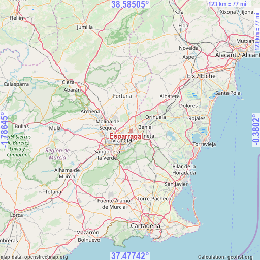
Esparragal GPS coordinates[2]
38° 1' 59.988" North, 1° 4' 59.988" West
| Map corner | latitude | longitude |
|---|---|---|
| Upper-left | 38.58505°, | -1.78645° |
| Center: | 38.03333°, | -1.08333° |
| Lower-right: | 37.47742°, | -0.3802° |
| Map W x H: | 123.2×123.2 km | = 76.6×76.6mi |
| max Lat: | 43.74134° ⇑88.3% North |
| Esparragal: | 38.03333° |
| min Lat: | ⇓11.7% South 27.64134° |
| min Long | Esparragal | max Long |
| -18.00367° | -1.08333° | 4.2899° |
| W 76.4%⇐ | ⇒23.6% E |
Elevation
Elevation of Esparragal is 44 m = 144 ft, and this is 554 m = 1818 ft below average elevation for this country.
| Max E: |
1682 m = 5518 ft | 92.1% |
| Avg. | 598 m = 1962 ft | |
| Esparragal | 44 m = 144 ft | |
Min E: |
0 m = 0 ft | 7.9% |
See also: Spain elevation on elevation.city.
Geographical zone
Esparragal is located in North temperate zone (between Tropic of Cancer and the Arctic Circle). Distance of this Northern Tropic circle is 1623 km =1008.5 mi to South.| Distance of | km | miles | from Esparragal |
|---|---|---|---|
| North Pole | 5778.2 | 3590.4 | to North |
| Arctic Circle | 3172.3 | 1971.2 | to North |
| Tropic Cancer | 1623 | 1008.5 | to South |
| Equator | 4228.9 | 2627.7 | to South |


Nearby cities:
15 places around Esparragal: (largest is in red/bold)
• Alcantarilla
13.7 km =8.5 mi,  238°
238°
• Alguazas
14.8 km =9.2 mi,  278°
278°
• Barrio de San José Obrero
3 km =1.9 mi,  101°
101°
• Benferri
16 km =9.9 mi,  41°
41°
• Beniel
7.2 km =4.5 mi,  78°
78°
• Cabecicos
2.2 km =1.4 mi,  174°
174°
• Cobatillas
2.5 km =1.6 mi,  13°
13°
• Las Torres de Cotillas
13.9 km =8.6 mi,  267°
267°
• Lorquí
15.7 km =9.8 mi,  290°
290°
• Molina de Segura
11.1 km =6.9 mi, 282°
• Murcia
6.6 km =4.1 mi,  218°
218°
• Orihuela
13.5 km =8.4 mi,  64°
64°
• Sangonera la Verde
16 km =9.9 mi, 223°
• Santa Cruz
2.6 km =1.6 mi,  119°
119°
• Santomera
4.4 km =2.7 mi, 44°
Sources, notices
• [Note1] Compared only with cities in Spain existing in our database
• [Src1] Map data: © OpenStreetMap contributors (CC-BY-SA)
• [Src2] Other city data from geonames.org with taken over terms of usage.
• [Src3] Geographical zone / Annual Mean Temperature by Robert A. Rohde @ Wikipedia
