Melilla geodata
Melilla is a seat of a first-order administrative division; located in Spain in Africa/Ceuta (GMT+2) time zone. With population of 73,460 people, there are 127 cities with bigger population in this country. Compared to other cities in Spain, 98.4% of cities are located further ↑North; 55.5% of cities are located further ←West and 97.3% of cities have higher elevation than Melilla. Note1


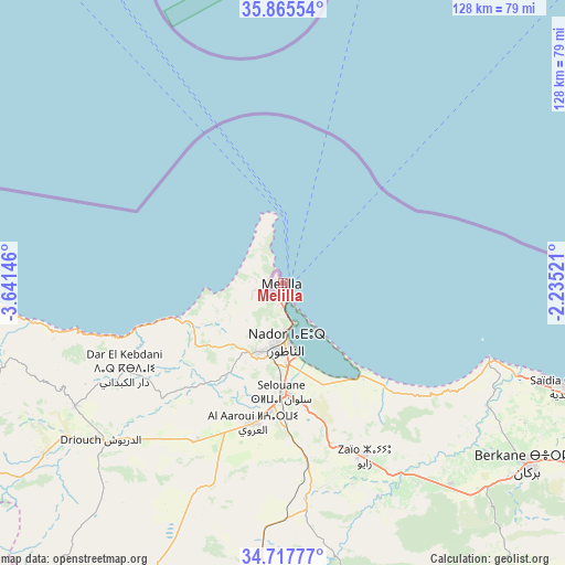
Melilla GPS coordinates[2]
35° 17' 37.284" North, 2° 56' 17.988" West
| Map corner | latitude | longitude |
|---|---|---|
| Upper-left | 35.86554°, | -3.64146° |
| Center: | 35.29369°, | -2.93833° |
| Lower-right: | 34.71777°, | -2.23521° |
| Map W x H: | 127.6×127.6 km | = 79.3×79.3mi |
| max Lat: | 43.74134° ⇑98.4% North |
| Melilla: | 35.29369° |
| min Lat: | ⇓1.6% South 27.64134° |
| min Long | Melilla | max Long |
| -18.00367° | -2.93833° | 4.2899° |
| W 55.5%⇐ | ⇒44.5% E |
Elevation
Elevation of Melilla is 14 m = 46 ft, and this is 584 m = 1916 ft below average elevation for this country.
| Max E: |
1682 m = 5518 ft | 97.3% |
| Avg. | 598 m = 1962 ft | |
| Melilla | 14 m = 46 ft | |
Min E: |
0 m = 0 ft | 2.7% |
See also: Melilla elevation on elevation.city.
Geographical zone
Melilla is located in North temperate zone (between Tropic of Cancer and the Arctic Circle). Distance of this Northern Tropic circle is 1318.4 km =819.2 mi to South.| Distance of | km | miles | from Melilla |
|---|---|---|---|
| North Pole | 6082.8 | 3779.7 | to North |
| Arctic Circle | 3476.9 | 2160.4 | to North |
| Tropic Cancer | 1318.4 | 819.2 | to South |
| Equator | 3924.3 | 2438.4 | to South |


Nearby cities:
15 places around Melilla: (largest is in red/bold)
• Adra
162.1 km =100.7 mi,  357°
357°
• Albuñol
168.3 km =104.6 mi,  351°
351°
• Balanegra
161.8 km =100.5 mi,  0°
0°
• Castell de Ferro
163.6 km =101.7 mi, 346°
• Dalías
170 km =105.6 mi, 2°
• El Ejido
165.2 km =102.7 mi, 3°
• El Varadero
167.6 km =104.1 mi,  341°
341°
• Gualchos
166.4 km =103.4 mi, 345°
• La Gangosa Vistasol
170.5 km =105.9 mi,  9°
9°
• Motril
170.2 km =105.8 mi, 342°
• Polopos
170 km =105.6 mi, 349°
• Roquetas de Mar
166.1 km =103.2 mi, 10°
• Salobreña
171.4 km =106.5 mi, 340°
• Sorvilán
169.5 km =105.3 mi, 349°
• Torrenueva
164.5 km =102.2 mi, 342°
Sources, notices
• [Note1] Compared only with cities in Spain existing in our database
• [Src1] Map data: © OpenStreetMap contributors (CC-BY-SA)
• [Src2] Other city data from geonames.org with taken over terms of usage.
• [Src3] Geographical zone / Annual Mean Temperature by Robert A. Rohde @ Wikipedia
