Adra geodata
Adra (Andalusia) is a seat of a third-order administrative division; located in Spain in Europe/Madrid (GMT+2) time zone. With population of 24,373 people, there are 382 cities with bigger population in this country. Compared to other cities in Spain, 97.2% of cities are located further ↑North; 54% of cities are located further ←West and 94.4% of cities have higher elevation than Adra. Note1


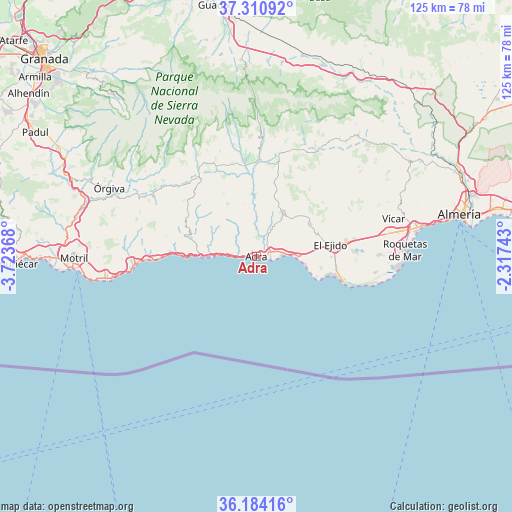
Adra GPS coordinates[2]
36° 44' 58.596" North, 3° 1' 13.98" West
| Map corner | latitude | longitude |
|---|---|---|
| Upper-left | 37.31092°, | -3.72368° |
| Center: | 36.74961°, | -3.02055° |
| Lower-right: | 36.18416°, | -2.31743° |
| Map W x H: | 125.3×125.3 km | = 77.9×77.9mi |
| max Lat: | 43.74134° ⇑97.2% North |
| Adra: | 36.74961° |
| min Lat: | ⇓2.8% South 27.64134° |
| min Long | Adra | max Long |
| -18.00367° | -3.02055° | 4.2899° |
| W 54%⇐ | ⇒46% E |
Elevation
Elevation of Adra is 28 m = 92 ft, and this is 570 m = 1870 ft below average elevation for this country.
| Max E: |
1682 m = 5518 ft | 94.4% |
| Avg. | 598 m = 1962 ft | |
| Adra | 28 m = 92 ft | |
Min E: |
0 m = 0 ft | 5.6% |
See also: Spain elevation on elevation.city.
Geographical zone
Adra is located in North temperate zone (between Tropic of Cancer and the Arctic Circle). Distance of this Northern Tropic circle is 1480.3 km =919.8 mi to South.| Distance of | km | miles | from Adra |
|---|---|---|---|
| North Pole | 5920.9 | 3679.1 | to North |
| Arctic Circle | 3315 | 2059.8 | to North |
| Tropic Cancer | 1480.3 | 919.8 | to South |
| Equator | 4086.2 | 2539 | to South |


Nearby cities:
15 places around Adra: (largest is in red/bold)
• Albondón
19.1 km =11.9 mi,  297°
297°
• Albuñol
17.1 km =10.6 mi,  286°
286°
• Alcolea
25.6 km =15.9 mi,  11°
11°
• Balanegra
9.9 km =6.2 mi,  90°
90°
• Berja
12.5 km =7.8 mi,  30°
30°
• Cádiar
26 km =16.2 mi,  326°
326°
• Dalías
15.5 km =9.6 mi,  58°
58°
• Darrícal
18.9 km =11.7 mi,  357°
357°
• El Ejido
18.6 km =11.6 mi,  80°
80°
• Lobras
26.2 km =16.3 mi,  319°
319°
• Murtas
17 km =10.6 mi, 332°
• Polopos
25.2 km =15.7 mi,  281°
281°
• Sorvilán
22.6 km =14 mi, 282°
• Ugíjar
23.7 km =14.7 mi,  352°
352°
• Válor
28 km =17.4 mi, 348°
Sources, notices
• [Note1] Compared only with cities in Spain existing in our database
• [Src1] Map data: © OpenStreetMap contributors (CC-BY-SA)
• [Src2] Other city data from geonames.org with taken over terms of usage.
• [Src3] Geographical zone / Annual Mean Temperature by Robert A. Rohde @ Wikipedia
