Gérgal geodata
Gérgal (Andalusia) is a seat of a third-order administrative division; located in Spain in Europe/Madrid (GMT+2) time zone. With population of 1,080 people, there are 2844 cities with bigger population in this country. Compared to other cities in Spain, 94.7% of cities are located further ↑North; 60.5% of cities are located further ←West and 61.4% of cities have lower elevation than Gérgal. Note1


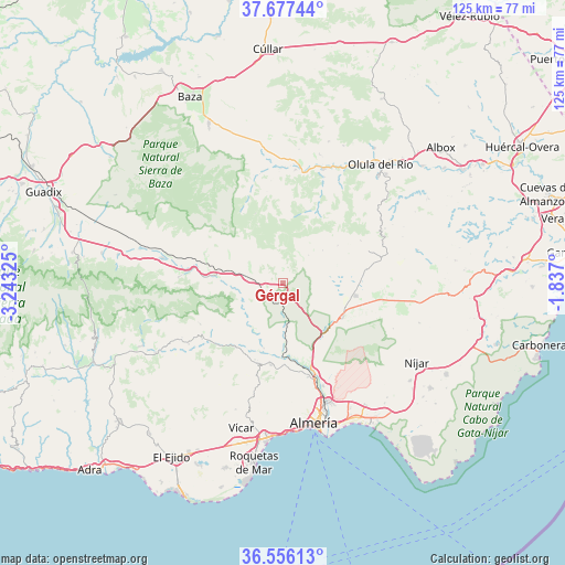
Gérgal GPS coordinates[2]
37° 7' 7.896" North, 2° 32' 24.432" West
| Map corner | latitude | longitude |
|---|---|---|
| Upper-left | 37.67744°, | -3.24325° |
| Center: | 37.11886°, | -2.54012° |
| Lower-right: | 36.55613°, | -1.837° |
| Map W x H: | 124.7×124.7 km | = 77.5×77.5mi |
| max Lat: | 43.74134° ⇑94.7% North |
| Gérgal: | 37.11886° |
| min Lat: | ⇓5.3% South 27.64134° |
| min Long | Gérgal | max Long |
| -18.00367° | -2.54012° | 4.2899° |
| W 60.5%⇐ | ⇒39.5% E |
Elevation
Elevation of Gérgal is 753 m = 2470 ft, and this is 155 m = 509 ft above average elevation for this country.
| Max E: |
1682 m = 5518 ft | 38.6% |
| Gérgal | 753 m 2470 ft | |
| Avg. | 598 m = 1962 ft | |
Min E: |
0 m = 0 ft | 61.4% |
See also: Spain elevation on elevation.city.
Geographical zone
Gérgal is located in North temperate zone (between Tropic of Cancer and the Arctic Circle). Distance of this Northern Tropic circle is 1521.3 km =945.3 mi to South.| Distance of | km | miles | from Gérgal |
|---|---|---|---|
| North Pole | 5879.8 | 3653.5 | to North |
| Arctic Circle | 3273.9 | 2034.3 | to North |
| Tropic Cancer | 1521.3 | 945.3 | to South |
| Equator | 4127.2 | 2564.5 | to South |


Nearby cities:
15 places around Gérgal: (largest is in red/bold)
• Albolodúy
11.9 km =7.4 mi,  217°
217°
• Alhabia
14.9 km =9.3 mi,  196°
196°
• Alhama de Almería
18.2 km =11.3 mi,  187°
187°
• Alicún
17.9 km =11.1 mi, 197°
• Alsodux
13.8 km =8.6 mi, 200°
• Bentarique
16.2 km =10.1 mi,  205°
205°
• Castro de Filabres
11.5 km =7.1 mi,  50°
50°
• Huécija
17.9 km =11.1 mi, 200°
• Illar
17.2 km =10.7 mi, 210°
• Instinción
17.6 km =10.9 mi, 217°
• Olula de Castro
8.5 km =5.3 mi,  43°
43°
• Santa Fe de Mondújar
16 km =9.9 mi,  177°
177°
• Tabernas
15.3 km =9.5 mi,  120°
120°
• Terque
15.8 km =9.8 mi, 198°
• Velefique
14.9 km =9.3 mi,  55°
55°
Sources, notices
• [Note1] Compared only with cities in Spain existing in our database
• [Src1] Map data: © OpenStreetMap contributors (CC-BY-SA)
• [Src2] Other city data from geonames.org with taken over terms of usage.
• [Src3] Geographical zone / Annual Mean Temperature by Robert A. Rohde @ Wikipedia
