Fuente-Tójar geodata
Fuente-Tójar (Andalusia) is a seat of a third-order administrative division; located in Spain in Europe/Madrid (GMT+2) time zone. With population of 807 people, there are 3195 cities with bigger population in this country. Compared to other cities in Spain, 91.3% of cities are located further ↑North; 61.9% of cities are located further →East and 55.6% of cities have higher elevation than Fuente-Tójar. Note1


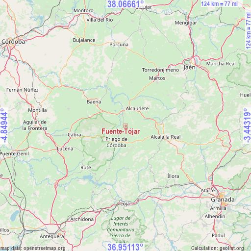
Fuente-Tójar GPS coordinates[2]
37° 30' 39.42" North, 4° 8' 46.716" West
| Map corner | latitude | longitude |
|---|---|---|
| Upper-left | 38.06661°, | -4.84944° |
| Center: | 37.51095°, | -4.14631° |
| Lower-right: | 36.95113°, | -3.44319° |
| Map W x H: | 124×124 km | = 77.1×77.1mi |
| max Lat: | 43.74134° ⇑91.3% North |
| Fuente-Tójar: | 37.51095° |
| min Lat: | ⇓8.7% South 27.64134° |
| min Long | Fuente-Tójar | max Long |
| -18.00367° | -4.14631° | 4.2899° |
| W 38.1%⇐ | ⇒61.9% E |
Elevation
Elevation of Fuente-Tójar is 587 m = 1926 ft, and this is 11 m = 36 ft below average elevation for this country.
| Max E: |
1682 m = 5518 ft | 55.6% |
| Avg. | 598 m = 1962 ft | |
| Fuente-Tójar | 587 m = 1926 ft | |
Min E: |
0 m = 0 ft | 44.4% |
See also: Spain elevation on elevation.city.
Geographical zone
Fuente-Tójar is located in North temperate zone (between Tropic of Cancer and the Arctic Circle). Distance of this Northern Tropic circle is 1564.9 km =972.4 mi to South.| Distance of | km | miles | from Fuente-Tójar |
|---|---|---|---|
| North Pole | 5836.2 | 3626.4 | to North |
| Arctic Circle | 3230.3 | 2007.2 | to North |
| Tropic Cancer | 1564.9 | 972.4 | to South |
| Equator | 4170.8 | 2591.6 | to South |


Nearby cities:
15 places around Fuente-Tójar: (largest is in red/bold)
• Alcalá la Real
20.5 km =12.7 mi,  105°
105°
• Alcaudete
10.5 km =6.5 mi,  32°
32°
• Algarinejo
20.7 km =12.9 mi,  182°
182°
• Almedinilla
9.4 km =5.8 mi,  148°
148°
• Baena
19.5 km =12.1 mi,  307°
307°
• Cabra
26.4 km =16.4 mi,  260°
260°
• Carcabuey
13.5 km =8.4 mi,  236°
236°
• Castillo de Locubín
18.1 km =11.2 mi,  83°
83°
• Doña Mencía
19.1 km =11.9 mi,  284°
284°
• Fuensanta de Martos
25.9 km =16.1 mi,  54°
54°
• Luque
12.9 km =8 mi,  293°
293°
• Montefrío
24.2 km =15 mi, 149°
• Priego de Córdoba
9.2 km =5.7 mi,  208°
208°
• Santiago de Calatrava
27.1 km =16.8 mi,  355°
355°
• Zuheros
15.3 km =9.5 mi, 283°
Sources, notices
• [Note1] Compared only with cities in Spain existing in our database
• [Src1] Map data: © OpenStreetMap contributors (CC-BY-SA)
• [Src2] Other city data from geonames.org with taken over terms of usage.
• [Src3] Geographical zone / Annual Mean Temperature by Robert A. Rohde @ Wikipedia
