Ontur geodata
Ontur (Castille-La Mancha) is a seat of a third-order administrative division; located in Spain in Europe/Madrid (GMT+2) time zone. With population of 2,431 people, there are 1928 cities with bigger population in this country. Compared to other cities in Spain, 84.8% of cities are located further ↑North; 73% of cities are located further ←West and 50.3% of cities have lower elevation than Ontur. Note1
Administrative division(s):
- Level 1: Castille-La Mancha
- Level 2: Provincia de Albacete
- Level 3: Ontur


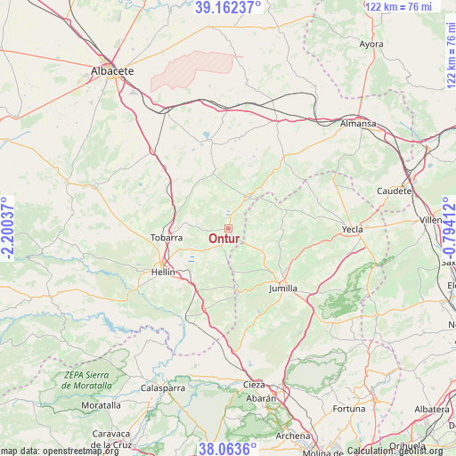
Ontur GPS coordinates[2]
38° 36' 54.324" North, 1° 29' 50.064" West
| Map corner | latitude | longitude |
|---|---|---|
| Upper-left | 39.16237°, | -2.20037° |
| Center: | 38.61509°, | -1.49724° |
| Lower-right: | 38.0636°, | -0.79412° |
| Map W x H: | 122.2×122.2 km | = 75.9×75.9mi |
| max Lat: | 43.74134° ⇑84.8% North |
| Ontur: | 38.61509° |
| min Lat: | ⇓15.2% South 27.64134° |
| min Long | Ontur | max Long |
| -18.00367° | -1.49724° | 4.2899° |
| W 73%⇐ | ⇒27% E |
Elevation
Elevation of Ontur is 662 m = 2172 ft, and this is 64 m = 210 ft above average elevation for this country.
| Max E: |
1682 m = 5518 ft | 49.7% |
| Ontur | 662 m 2172 ft | |
| Avg. | 598 m = 1962 ft | |
Min E: |
0 m = 0 ft | 50.3% |
See also: Spain elevation on elevation.city.
Geographical zone
Ontur is located in North temperate zone (between Tropic of Cancer and the Arctic Circle). Distance of this Northern Tropic circle is 1687.7 km =1048.7 mi to South.| Distance of | km | miles | from Ontur |
|---|---|---|---|
| North Pole | 5713.5 | 3550.2 | to North |
| Arctic Circle | 3107.6 | 1931 | to North |
| Tropic Cancer | 1687.7 | 1048.7 | to South |
| Equator | 4293.6 | 2667.9 | to South |


Nearby cities:
15 places around Ontur: (largest is in red/bold)
• Albatana
5.4 km =3.4 mi,  203°
203°
• Bonete
31.3 km =19.4 mi,  24°
24°
• Chinchilla de Monte Aragón
39.1 km =24.3 mi,  330°
330°
• Corral-Rubio
24.6 km =15.3 mi,  7°
7°
• Fuente-Álamo
10.4 km =6.5 mi,  33°
33°
• Hellín
21.2 km =13.2 mi,  236°
236°
• Higueruela
39 km =24.2 mi, 6°
• Hoya-Gonzalo
38.5 km =23.9 mi,  352°
352°
• Jumilla
21.3 km =13.2 mi,  135°
135°
• Montealegre del Castillo
24.3 km =15.1 mi,  37°
37°
• Pozo-Cañada
29.4 km =18.3 mi,  315°
315°
• Pozohondo
37.9 km =23.5 mi,  288°
288°
• Pétrola
24 km =14.9 mi, 347°
• Tobarra
17.1 km =10.6 mi,  261°
261°
• Yecla
33.2 km =20.6 mi,  90°
90°
Sources, notices
• [Note1] Compared only with cities in Spain existing in our database
• [Src1] Map data: © OpenStreetMap contributors (CC-BY-SA)
• [Src2] Other city data from geonames.org with taken over terms of usage.
• [Src3] Geographical zone / Annual Mean Temperature by Robert A. Rohde @ Wikipedia
