Algámitas geodata
Algámitas (Andalusia) is a seat of a third-order administrative division; located in Spain in Europe/Madrid (GMT+2) time zone. With population of 1,335 people, there are 2610 cities with bigger population in this country. Compared to other cities in Spain, 95.1% of cities are located further ↑North; 74.4% of cities are located further →East and 67.8% of cities have higher elevation than Algámitas. Note1


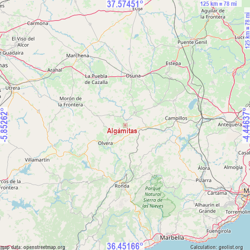
Algámitas GPS coordinates[2]
37° 0' 54.576" North, 5° 8' 58.164" West
| Map corner | latitude | longitude |
|---|---|---|
| Upper-left | 37.57451°, | -5.85262° |
| Center: | 37.01516°, | -5.14949° |
| Lower-right: | 36.45166°, | -4.44637° |
| Map W x H: | 124.8×124.8 km | = 77.5×77.5mi |
| max Lat: | 43.74134° ⇑95.1% North |
| Algámitas: | 37.01516° |
| min Lat: | ⇓4.9% South 27.64134° |
| min Long | Algámitas | max Long |
| -18.00367° | -5.14949° | 4.2899° |
| W 25.6%⇐ | ⇒74.4% E |
Elevation
Elevation of Algámitas is 421 m = 1381 ft, and this is 177 m = 581 ft below average elevation for this country.
| Max E: |
1682 m = 5518 ft | 67.8% |
| Avg. | 598 m = 1962 ft | |
| Algámitas | 421 m = 1381 ft | |
Min E: |
0 m = 0 ft | 32.2% |
See also: Spain elevation on elevation.city.
Geographical zone
Algámitas is located in North temperate zone (between Tropic of Cancer and the Arctic Circle). Distance of this Northern Tropic circle is 1509.8 km =938.1 mi to South.| Distance of | km | miles | from Algámitas |
|---|---|---|---|
| North Pole | 5891.4 | 3660.7 | to North |
| Arctic Circle | 3285.5 | 2041.5 | to North |
| Tropic Cancer | 1509.8 | 938.1 | to South |
| Equator | 4115.7 | 2557.4 | to South |


Nearby cities:
15 places around Algámitas: (largest is in red/bold)
• Alcalá del Valle
12.5 km =7.8 mi,  189°
189°
• Almargen
11.4 km =7.1 mi,  97°
97°
• Cañete la Real
13.2 km =8.2 mi,  122°
122°
• Cuevas del Becerro
18.1 km =11.2 mi,  149°
149°
• El Gastor
23.6 km =14.7 mi,  220°
220°
• El Saucejo
7.8 km =4.8 mi,  35°
35°
• Los Corrales
17.4 km =10.8 mi,  57°
57°
• Martín de la Jara
19.5 km =12.1 mi, 57°
• Olvera
13.8 km =8.6 mi,  229°
229°
• Pruna
8 km =5 mi, 233°
• Serrato
20.8 km =12.9 mi,  134°
134°
• Setenil de las Bodegas
17.1 km =10.6 mi, 189°
• Teba
20.8 km =12.9 mi, 99°
• Torre Alháquime
13.3 km =8.3 mi,  214°
214°
• Villanueva de San Juan
4.5 km =2.8 mi,  328°
328°
Sources, notices
• [Note1] Compared only with cities in Spain existing in our database
• [Src1] Map data: © OpenStreetMap contributors (CC-BY-SA)
• [Src2] Other city data from geonames.org with taken over terms of usage.
• [Src3] Geographical zone / Annual Mean Temperature by Robert A. Rohde @ Wikipedia
