Villanúa geodata
Villanúa (Aragon) is a seat of a third-order administrative division; located in Spain in Europe/Madrid (GMT+2) time zone. With population of 411 people, there are 4111 cities with bigger population in this country. Compared to other cities in Spain, 91.2% of cities are located further ↓South; 81.3% of cities are located further ←West and 85.6% of cities have lower elevation than Villanúa. Note1


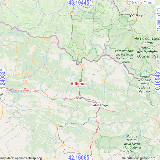
Villanúa GPS coordinates[2]
42° 40' 46.92" North, 0° 32' 15.684" West
| Map corner | latitude | longitude |
|---|---|---|
| Upper-left | 43.19445°, | -1.24082° |
| Center: | 42.6797°, | -0.53769° |
| Lower-right: | 42.16065°, | 0.16543° |
| Map W x H: | 114.9×114.9 km | = 71.4×71.4mi |
| max Lat: | 43.74134° ⇑8.8% North |
| Villanúa: | 42.6797° |
| min Lat: | ⇓91.2% South 27.64134° |
| min Long | Villanúa | max Long |
| -18.00367° | -0.53769° | 4.2899° |
| W 81.3%⇐ | ⇒18.7% E |
Elevation
Elevation of Villanúa is 959 m = 3146 ft, and this is 361 m = 1184 ft above average elevation for this country.
| Max E: |
1682 m = 5518 ft | 14.4% |
| Villanúa | 959 m 3146 ft | |
| Avg. | 598 m = 1962 ft | |
Min E: |
0 m = 0 ft | 85.6% |
See also: Spain elevation on elevation.city.
Geographical zone
Villanúa is located in North temperate zone (between Tropic of Cancer and the Arctic Circle). Distance of this Northern Tropic circle is 2139.6 km =1329.5 mi to South.| Distance of | km | miles | from Villanúa |
|---|---|---|---|
| North Pole | 5261.5 | 3269.3 | to North |
| Arctic Circle | 2655.6 | 1650.1 | to North |
| Tropic Cancer | 2139.6 | 1329.5 | to South |
| Equator | 4745.5 | 2948.7 | to South |


Nearby cities:
15 places around Villanúa: (largest is in red/bold)
• Aragüés del Puerto
11.2 km =7 mi,  285°
285°
• Biescas
18.6 km =11.6 mi,  107°
107°
• Borau
4.8 km =3 mi,  240°
240°
• Canfranc
4.2 km =2.6 mi,  13°
13°
• Castiello de Jaca
5.7 km =3.5 mi,  190°
190°
• Echo
18.5 km =11.5 mi, 290°
• Hoz de Jaca
18.9 km =11.7 mi,  86°
86°
• Jaca
12.4 km =7.7 mi,  184°
184°
• Jasa
10.6 km =6.6 mi,  279°
279°
• Panticosa
21.5 km =13.4 mi,  76°
76°
• Puente la Reina de Jaca
24.5 km =15.2 mi, 236°
• Sabiñánigo
22.7 km =14.1 mi,  141°
141°
• Sallent de Gállego
19.5 km =12.1 mi,  58°
58°
• Santa Cruz de la Serós
20.8 km =12.9 mi,  212°
212°
• Yésero
24.5 km =15.2 mi, 105°
Sources, notices
• [Note1] Compared only with cities in Spain existing in our database
• [Src1] Map data: © OpenStreetMap contributors (CC-BY-SA)
• [Src2] Other city data from geonames.org with taken over terms of usage.
• [Src3] Geographical zone / Annual Mean Temperature by Robert A. Rohde @ Wikipedia
