Panticosa geodata
Panticosa (Aragon) is a populated place; located in Spain in Europe/Madrid (GMT+2) time zone. With population of 711 people, there are 3386 cities with bigger population in this country. Compared to other cities in Spain, 91.8% of cities are located further ↓South; 84.7% of cities are located further ←West and 96.5% of cities have lower elevation than Panticosa. Note1


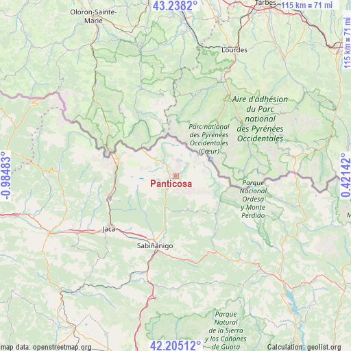
Panticosa GPS coordinates[2]
42° 43' 25.716" North, 0° 16' 54.12" West
| Map corner | latitude | longitude |
|---|---|---|
| Upper-left | 43.2382°, | -0.98483° |
| Center: | 42.72381°, | -0.2817° |
| Lower-right: | 42.20512°, | 0.42142° |
| Map W x H: | 114.9×114.9 km | = 71.4×71.4mi |
| max Lat: | 43.74134° ⇑8.2% North |
| Panticosa: | 42.72381° |
| min Lat: | ⇓91.8% South 27.64134° |
| min Long | Panticosa | max Long |
| -18.00367° | -0.2817° | 4.2899° |
| W 84.7%⇐ | ⇒15.3% E |
Elevation
Elevation of Panticosa is 1189 m = 3901 ft, and this is 591 m = 1939 ft above average elevation for this country.
| Max E: |
1682 m = 5518 ft | 3.5% |
| Panticosa | 1189 m 3901 ft | |
| Avg. | 598 m = 1962 ft | |
Min E: |
0 m = 0 ft | 96.5% |
See also: Spain elevation on elevation.city.
Geographical zone
Panticosa is located in North temperate zone (between Tropic of Cancer and the Arctic Circle). Distance of this Northern Tropic circle is 2144.5 km =1332.5 mi to South.| Distance of | km | miles | from Panticosa |
|---|---|---|---|
| North Pole | 5256.6 | 3266.3 | to North |
| Arctic Circle | 2650.7 | 1647.1 | to North |
| Tropic Cancer | 2144.5 | 1332.5 | to South |
| Equator | 4750.4 | 2951.8 | to South |


Nearby cities:
15 places around Panticosa: (largest is in red/bold)
• Aragüés del Puerto
31.8 km =19.8 mi,  266°
266°
• Biescas
11 km =6.8 mi,  197°
197°
• Borau
26.1 km =16.2 mi,  253°
253°
• Broto
18.5 km =11.5 mi,  135°
135°
• Canfranc
19.9 km =12.4 mi, 267°
• Castiello de Jaca
24.3 km =15.1 mi,  244°
244°
• Fiscal
28.6 km =17.8 mi,  152°
152°
• Hoz de Jaca
4.2 km =2.6 mi,  208°
208°
• Jaca
27.9 km =17.3 mi,  231°
231°
• Jasa
31.6 km =19.6 mi,  264°
264°
• Sabiñánigo
23.8 km =14.8 mi, 196°
• Sallent de Gállego
6.8 km =4.2 mi,  320°
320°
• Villanúa
21.5 km =13.4 mi, 256°
• Yebra de Basa
26.4 km =16.4 mi,  180°
180°
• Yésero
11.9 km =7.4 mi,  167°
167°
Sources, notices
• [Note1] Compared only with cities in Spain existing in our database
• [Src1] Map data: © OpenStreetMap contributors (CC-BY-SA)
• [Src2] Other city data from geonames.org with taken over terms of usage.
• [Src3] Geographical zone / Annual Mean Temperature by Robert A. Rohde @ Wikipedia
