Oroso geodata
Oroso (Galicia) is a populated place; located in Spain in Europe/Madrid (GMT+2) time zone. With population of 6,378 people, there are 1094 cities with bigger population in this country. Compared to other cities in Spain, 94.3% of cities are located further ↓South; 97.2% of cities are located further →East and 76.7% of cities have higher elevation than Oroso. Note1
Administrative division(s):
- Level 1: Galicia
- Level 2: Provincia da Coruña
- Level 3: Santiago de Compostela


Oroso GPS coordinates[2]
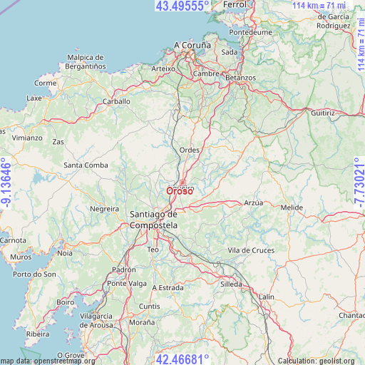
42° 58' 59.988" North, 8° 25' 59.988" West
| Map corner | latitude | longitude |
|---|---|---|
| Upper-left | 43.49555°, | -9.13646° |
| Center: | 42.98333°, | -8.43333° |
| Lower-right: | 42.46681°, | -7.73021° |
| Map W x H: | 114.4×114.4 km | = 71.1×71.1mi |
| max Lat: | 43.74134° ⇑5.7% North |
| Oroso: | 42.98333° |
| min Lat: | ⇓94.3% South 27.64134° |
| min Long | Oroso | max Long |
| -18.00367° | -8.43333° | 4.2899° |
| W 2.8%⇐ | ⇒97.2% E |
Elevation
Elevation of Oroso is 274 m = 899 ft, and this is 324 m = 1063 ft below average elevation for this country.
| Max E: |
1682 m = 5518 ft | 76.7% |
| Avg. | 598 m = 1962 ft | |
| Oroso | 274 m = 899 ft | |
Min E: |
0 m = 0 ft | 23.3% |
See also: Spain elevation on elevation.city.
Geographical zone
Oroso is located in North temperate zone (between Tropic of Cancer and the Arctic Circle). Distance of this Northern Tropic circle is 2173.4 km =1350.5 mi to South.| Distance of | km | miles | from Oroso |
|---|---|---|---|
| North Pole | 5227.8 | 3248.4 | to North |
| Arctic Circle | 2621.9 | 1629.2 | to North |
| Tropic Cancer | 2173.4 | 1350.5 | to South |
| Equator | 4779.3 | 2969.7 | to South |


Nearby cities:
15 places around Oroso: (largest is in red/bold)
• A Baña
26.5 km =16.5 mi,  264°
264°
• Amés
20.1 km =12.5 mi,  244°
244°
• Arzúa
23.7 km =14.7 mi,  103°
103°
• Boimorto
24.5 km =15.2 mi,  85°
85°
• Cerceda
22.6 km =14 mi,  349°
349°
• Frades
13.6 km =8.5 mi,  56°
56°
• Mesia
18.8 km =11.7 mi,  46°
46°
• Negreira
26.7 km =16.6 mi,  250°
250°
• Ordes
10.6 km =6.6 mi,  10°
10°
• Ribeira
26.4 km =16.4 mi,  181°
181°
• Santiago de Compostela
14.6 km =9.1 mi,  218°
218°
• Teo
26.5 km =16.5 mi,  191°
191°
• Touro
16.4 km =10.2 mi,  141°
141°
• Trazo
8.9 km =5.5 mi,  294°
294°
• Vedra
23.1 km =14.4 mi, 188°
Sources, notices
• [Note1] Compared only with cities in Spain existing in our database
• [Src1] Map data: © OpenStreetMap contributors (CC-BY-SA)
• [Src2] Other city data from geonames.org with taken over terms of usage.
• [Src3] Geographical zone / Annual Mean Temperature by Robert A. Rohde @ Wikipedia
