Torre del Bierzo geodata
Torre del Bierzo (Castille and León) is a seat of a third-order administrative division; located in Spain in Europe/Madrid (GMT+2) time zone. With population of 2,613 people, there are 1858 cities with bigger population in this country. Compared to other cities in Spain, 89.7% of cities are located further ↓South; 90.1% of cities are located further →East and 53.9% of cities have lower elevation than Torre del Bierzo. Note1
Administrative division(s):
- Level 1: Castille and León
- Level 2: Provincia de León
- Level 3: Torre del Bierzo


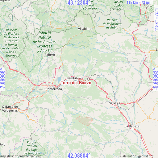
Torre del Bierzo GPS coordinates[2]
42° 36' 27.684" North, 6° 22' 0.3" West
| Map corner | latitude | longitude |
|---|---|---|
| Upper-left | 43.12304°, | -7.06988° |
| Center: | 42.60769°, | -6.36675° |
| Lower-right: | 42.08804°, | -5.66363° |
| Map W x H: | 115.1×115.1 km | = 71.5×71.5mi |
| max Lat: | 43.74134° ⇑10.3% North |
| Torre del Bierzo: | 42.60769° |
| min Lat: | ⇓89.7% South 27.64134° |
| min Long | Torre del Bierz | max Long |
| -18.00367° | -6.36675° | 4.2899° |
| W 9.9%⇐ | ⇒90.1% E |
Elevation
Elevation of Torre del Bierzo is 700 m = 2297 ft, and this is 102 m = 335 ft above average elevation for this country.
| Max E: |
1682 m = 5518 ft | 46.1% |
| Torre del Bierzo | 700 m 2297 ft | |
| Avg. | 598 m = 1962 ft | |
Min E: |
0 m = 0 ft | 53.9% |
See also: Spain elevation on elevation.city.
Geographical zone
Torre del Bierzo is located in North temperate zone (between Tropic of Cancer and the Arctic Circle). Distance of this Northern Tropic circle is 2131.6 km =1324.5 mi to South.| Distance of | km | miles | from Torre del Bierzo |
|---|---|---|---|
| North Pole | 5269.5 | 3274.3 | to North |
| Arctic Circle | 2663.6 | 1655.1 | to North |
| Tropic Cancer | 2131.6 | 1324.5 | to South |
| Equator | 4737.5 | 2943.7 | to South |


Nearby cities:
15 places around Torre del Bierzo: (largest is in red/bold)
• Bembibre
4.1 km =2.5 mi,  285°
285°
• Berlanga del Bierzo
23.9 km =14.9 mi,  305°
305°
• Brazuelo
21.1 km =13.1 mi,  125°
125°
• Camponaraya
24.8 km =15.4 mi,  262°
262°
• Castropodame
8.9 km =5.5 mi,  249°
249°
• Congosto
12.6 km =7.8 mi,  274°
274°
• Cubillos del Sil
16.2 km =10.1 mi,  276°
276°
• Folgoso de la Ribera
5.8 km =3.6 mi,  41°
41°
• Igüeña
15.3 km =9.5 mi,  28°
28°
• Molinaseca
14.7 km =9.1 mi,  238°
238°
• Ponferrada
20 km =12.4 mi, 250°
• Sancedo
22.9 km =14.2 mi, 286°
• Santa Colomba de Somoza
20.7 km =12.9 mi,  151°
151°
• Toreno
15.7 km =9.8 mi, 310°
• Villagatón
17 km =10.6 mi,  80°
80°
Sources, notices
• [Note1] Compared only with cities in Spain existing in our database
• [Src1] Map data: © OpenStreetMap contributors (CC-BY-SA)
• [Src2] Other city data from geonames.org with taken over terms of usage.
• [Src3] Geographical zone / Annual Mean Temperature by Robert A. Rohde @ Wikipedia
