Pozondón geodata
Pozondón (Aragon) is a seat of a third-order administrative division; located in Spain in Europe/Madrid (GMT+2) time zone. With population of 100 people, there are 5934 cities with bigger population in this country. Compared to other cities in Spain, 60.6% of cities are located further ↑North; 73.2% of cities are located further ←West and 99.5% of cities have lower elevation than Pozondón. Note1


Pozondón GPS coordinates[2]
40° 33' 40.032" North, 1° 28' 13.188" West
| Map corner | latitude | longitude |
|---|---|---|
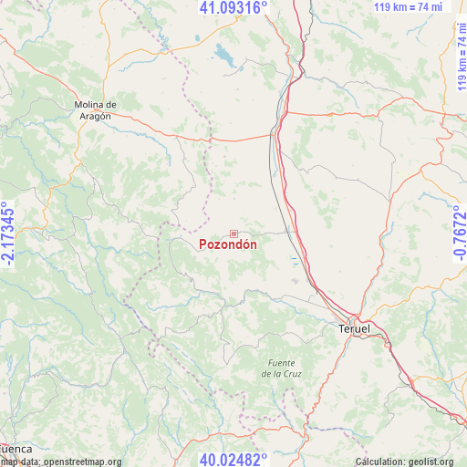
| Upper-left | 41.09316°, | -2.17345° |
| Center: | 40.56112°, | -1.47033° |
| Lower-right: | 40.02482°, | -0.7672° |
| Map W x H: | 118.8×118.8 km | = 73.8×73.8mi |
| max Lat: | 43.74134° ⇑60.6% North |
| Pozondón: | 40.56112° |
| min Lat: | ⇓39.4% South 27.64134° |
| min Long | Pozondón | max Long |
| -18.00367° | -1.47033° | 4.2899° |
| W 73.2%⇐ | ⇒26.8% E |
Elevation
Elevation of Pozondón is 1408 m = 4619 ft, and this is 810 m = 2657 ft above average elevation for this country.
| Max E: |
1682 m = 5518 ft | 0.5% |
| Pozondón | 1408 m 4619 ft | |
| Avg. | 598 m = 1962 ft | |
Min E: |
0 m = 0 ft | 99.5% |
See also: Spain elevation on elevation.city.
Geographical zone
Pozondón is located in North temperate zone (between Tropic of Cancer and the Arctic Circle). Distance of this Northern Tropic circle is 1904.1 km =1183.2 mi to South.| Distance of | km | miles | from Pozondón |
|---|---|---|---|
| North Pole | 5497.1 | 3415.7 | to North |
| Arctic Circle | 2891.2 | 1796.5 | to North |
| Tropic Cancer | 1904.1 | 1183.2 | to South |
| Equator | 4510 | 2802.4 | to South |


Nearby cities:
15 places around Pozondón: (largest is in red/bold)
• Alba
12.2 km =7.6 mi,  58°
58°
• Albarracín
17.2 km =10.7 mi,  172°
172°
• Almohaja
5.6 km =3.5 mi,  29°
29°
• Alustante
17 km =10.6 mi,  290°
290°
• Bronchales
11.4 km =7.1 mi,  241°
241°
• Monterde de Albarracín
7.4 km =4.6 mi,  194°
194°
• Orihuela del Tremedal
15.2 km =9.4 mi,  265°
265°
• Peracense
8.9 km =5.5 mi,  359°
359°
• Ródenas
9.7 km =6 mi,  336°
336°
• Santa Eulalia
13.3 km =8.3 mi,  86°
86°
• Singra
17 km =10.6 mi,  52°
52°
• Tordesilos
16 km =9.9 mi,  319°
319°
• Torres de Albarracín
15.8 km =9.8 mi,  199°
199°
• Tramacastilla
17 km =10.6 mi,  211°
211°
• Villar del Salz
13.7 km =8.5 mi,  349°
349°
Sources, notices
• [Note1] Compared only with cities in Spain existing in our database
• [Src1] Map data: © OpenStreetMap contributors (CC-BY-SA)
• [Src2] Other city data from geonames.org with taken over terms of usage.
• [Src3] Geographical zone / Annual Mean Temperature by Robert A. Rohde @ Wikipedia
