Peñaparda geodata
Peñaparda (Castille and León) is a seat of a third-order administrative division; located in Spain in Europe/Madrid (GMT+2) time zone. With population of 439 people, there are 4031 cities with bigger population in this country. Compared to other cities in Spain, 65.5% of cities are located further ↑North; 92.6% of cities are located further →East and 76.6% of cities have lower elevation than Peñaparda. Note1
Administrative division(s):
- Level 1: Castille and León
- Level 2: Provincia de Salamanca
- Level 3: Peñaparda


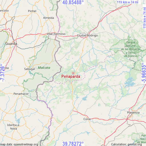
Peñaparda GPS coordinates[2]
40° 19' 15.348" North, 6° 40' 10.128" West
| Map corner | latitude | longitude |
|---|---|---|
| Upper-left | 40.85488°, | -7.3726° |
| Center: | 40.32093°, | -6.66948° |
| Lower-right: | 39.78272°, | -5.96635° |
| Map W x H: | 119.2×119.2 km | = 74.1×74.1mi |
| max Lat: | 43.74134° ⇑65.5% North |
| Peñaparda: | 40.32093° |
| min Lat: | ⇓34.5% South 27.64134° |
| min Long | Peñaparda | max Long |
| -18.00367° | -6.66948° | 4.2899° |
| W 7.4%⇐ | ⇒92.6% E |
Elevation
Elevation of Peñaparda is 866 m = 2841 ft, and this is 268 m = 879 ft above average elevation for this country.
| Max E: |
1682 m = 5518 ft | 23.4% |
| Peñaparda | 866 m 2841 ft | |
| Avg. | 598 m = 1962 ft | |
Min E: |
0 m = 0 ft | 76.6% |
See also: Spain elevation on elevation.city.
Geographical zone
Peñaparda is located in North temperate zone (between Tropic of Cancer and the Arctic Circle). Distance of this Northern Tropic circle is 1877.3 km =1166.5 mi to South.| Distance of | km | miles | from Peñaparda |
|---|---|---|---|
| North Pole | 5523.8 | 3432.3 | to North |
| Arctic Circle | 2917.9 | 1813.1 | to North |
| Tropic Cancer | 1877.3 | 1166.5 | to South |
| Equator | 4483.3 | 2785.8 | to South |


Nearby cities:
15 places around Peñaparda: (largest is in red/bold)
• Acebo
13.9 km =8.6 mi,  196°
196°
• Cadalso
14.3 km =8.9 mi,  130°
130°
• Casillas de Flores
9.9 km =6.2 mi,  312°
312°
• Descargamaría
15.6 km =9.7 mi,  96°
96°
• Fuenteguinaldo
12 km =7.5 mi,  357°
357°
• Gata
11.1 km =6.9 mi,  146°
146°
• Hoyos
17.2 km =10.7 mi,  194°
194°
• Navasfrías
13 km =8.1 mi,  258°
258°
• Puebla de Azaba
15.5 km =9.6 mi,  335°
335°
• Robleda
8.8 km =5.5 mi,  36°
36°
• Robledillo de Gata
16.8 km =10.4 mi,  89°
89°
• San Martín de Trevejo
16.1 km =10 mi,  221°
221°
• Torre de Don Miguel
13.4 km =8.3 mi,  144°
144°
• Villasbuenas de Gata
16.2 km =10.1 mi,  166°
166°
• Villasrubias
3.2 km =2 mi,  53°
53°
Sources, notices
• [Note1] Compared only with cities in Spain existing in our database
• [Src1] Map data: © OpenStreetMap contributors (CC-BY-SA)
• [Src2] Other city data from geonames.org with taken over terms of usage.
• [Src3] Geographical zone / Annual Mean Temperature by Robert A. Rohde @ Wikipedia
