Santillana geodata
Santillana (Cantabria) is a populated place; located in Spain in Europe/Madrid (GMT+2) time zone. With population of 4,042 people, there are 1467 cities with bigger population in this country. Compared to other cities in Spain, 98.7% of cities are located further ↓South; 61.3% of cities are located further →East and 88.8% of cities have higher elevation than Santillana. Note1
Administrative division(s):
- Level 1: Cantabria
- Level 2: Provincia de Cantabria
- Level 3: Santillana del Mar


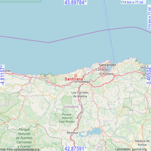
Santillana GPS coordinates[2]
43° 23' 20.508" North, 4° 6' 30.384" West
| Map corner | latitude | longitude |
|---|---|---|
| Upper-left | 43.89784°, | -4.81157° |
| Center: | 43.38903°, | -4.10844° |
| Lower-right: | 42.87591°, | -3.40532° |
| Map W x H: | 113.6×113.6 km | = 70.6×70.6mi |
| max Lat: | 43.74134° ⇑1.3% North |
| Santillana: | 43.38903° |
| min Lat: | ⇓98.7% South 27.64134° |
| min Long | Santillana | max Long |
| -18.00367° | -4.10844° | 4.2899° |
| W 38.7%⇐ | ⇒61.3% E |
Elevation
Elevation of Santillana is 84 m = 276 ft, and this is 514 m = 1686 ft below average elevation for this country.
| Max E: |
1682 m = 5518 ft | 88.8% |
| Avg. | 598 m = 1962 ft | |
| Santillana | 84 m = 276 ft | |
Min E: |
0 m = 0 ft | 11.2% |
See also: Spain elevation on elevation.city.
Geographical zone
Santillana is located in North temperate zone (between Tropic of Cancer and the Arctic Circle). Distance of this Northern Tropic circle is 2218.5 km =1378.5 mi to South.| Distance of | km | miles | from Santillana |
|---|---|---|---|
| North Pole | 5182.7 | 3220.4 | to North |
| Arctic Circle | 2576.8 | 1601.1 | to North |
| Tropic Cancer | 2218.5 | 1378.5 | to South |
| Equator | 4824.4 | 2997.7 | to South |


Nearby cities:
15 places around Santillana: (largest is in red/bold)
• Barrio de la Iglesia
11.5 km =7.1 mi,  265°
265°
• Cabezón de la Sal
13.7 km =8.5 mi,  228°
228°
• Camargo
18.2 km =11.3 mi,  83°
83°
• Cartes
7.7 km =4.8 mi,  155°
155°
• Comillas
14.8 km =9.2 mi, 268°
• Los Corrales de Buelna
14.2 km =8.8 mi,  168°
168°
• Luzmela
13.1 km =8.1 mi,  218°
218°
• Miengo
9.9 km =6.2 mi,  63°
63°
• Polanco
7.4 km =4.6 mi,  93°
93°
• Puente Viesgo
15.2 km =9.4 mi,  131°
131°
• Reocín
5.7 km =3.5 mi, 168°
• Ruente
19.4 km =12.1 mi, 221°
• Santa Cruz de Bezana
17.7 km =11 mi,  69°
69°
• Suances
7.2 km =4.5 mi,  46°
46°
• Torrelavega
6.6 km =4.1 mi, 131°
Sources, notices
• [Note1] Compared only with cities in Spain existing in our database
• [Src1] Map data: © OpenStreetMap contributors (CC-BY-SA)
• [Src2] Other city data from geonames.org with taken over terms of usage.
• [Src3] Geographical zone / Annual Mean Temperature by Robert A. Rohde @ Wikipedia
