La Selva del Camp geodata
La Selva del Camp (Catalonia) is a populated place; located in Spain in Europe/Madrid (GMT+2) time zone. With population of 4,746 people, there are 1352 cities with bigger population in this country. Compared to other cities in Spain, 53.5% of cities are located further ↓South; 90.8% of cities are located further ←West and 78.8% of cities have higher elevation than La Selva del Camp. Note1
Administrative division(s):
- Level 1: Catalonia
- Level 2: Província de Tarragona
- Level 3: la Selva del Camp


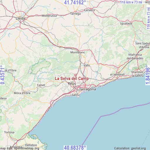
La Selva del Camp GPS coordinates[2]
41° 12' 53.424" North, 1° 8' 19.788" East
| Map corner | latitude | longitude |
|---|---|---|
| Upper-left | 41.74162°, | 0.43571° |
| Center: | 41.21484°, | 1.13883° |
| Lower-right: | 40.68378°, | 1.84196° |
| Map W x H: | 117.6×117.6 km | = 73.1×73.1mi |
| max Lat: | 43.74134° ⇑46.5% North |
| La Selva del Camp: | 41.21484° |
| min Lat: | ⇓53.5% South 27.64134° |
| min Long | La Selva del Ca | max Long |
| -18.00367° | 1.13883° | 4.2899° |
| W 90.8%⇐ | ⇒9.2% E |
Elevation
Elevation of La Selva del Camp is 241 m = 791 ft, and this is 357 m = 1171 ft below average elevation for this country.
| Max E: |
1682 m = 5518 ft | 78.8% |
| Avg. | 598 m = 1962 ft | |
| La Selva del Camp | 241 m = 791 ft | |
Min E: |
0 m = 0 ft | 21.2% |
See also: Spain elevation on elevation.city.
Geographical zone
La Selva del Camp is located in North temperate zone (between Tropic of Cancer and the Arctic Circle). Distance of this Northern Tropic circle is 1976.7 km =1228.3 mi to South.| Distance of | km | miles | from La Selva del Camp |
|---|---|---|---|
| North Pole | 5424.4 | 3370.6 | to North |
| Arctic Circle | 2818.5 | 1751.3 | to North |
| Tropic Cancer | 1976.7 | 1228.3 | to South |
| Equator | 4582.7 | 2847.6 | to South |


Nearby cities:
15 places around La Selva del Camp: (largest is in red/bold)
• Alcover
5.9 km =3.7 mi,  26°
26°
• Almoster
3 km =1.9 mi,  229°
229°
• Constantí
9.2 km =5.7 mi,  137°
137°
• La Canonja
11 km =6.8 mi,  161°
161°
• La Secuita
11.9 km =7.4 mi,  95°
95°
• Maspujols
8.6 km =5.3 mi,  245°
245°
• Mont-ral
8.3 km =5.2 mi,  336°
336°
• Perafort
10.1 km =6.3 mi, 104°
• Reus
7.1 km =4.4 mi,  202°
202°
• Riudoms
11.7 km =7.3 mi,  219°
219°
• Vallmoll
9.7 km =6 mi,  71°
71°
• Vila-seca
11.5 km =7.1 mi,  176°
176°
• Vilaplana
9 km =5.6 mi,  279°
279°
• la Pobla de Mafumet
7.4 km =4.6 mi,  118°
118°
• les Borges del Camp
11.5 km =7.1 mi,  242°
242°
Sources, notices
• [Note1] Compared only with cities in Spain existing in our database
• [Src1] Map data: © OpenStreetMap contributors (CC-BY-SA)
• [Src2] Other city data from geonames.org with taken over terms of usage.
• [Src3] Geographical zone / Annual Mean Temperature by Robert A. Rohde @ Wikipedia
