Cuevas de Vinromá geodata
Cuevas de Vinromá (Valencia) is a populated place; located in Spain in Europe/Madrid (GMT+2) time zone. With population of 1,889 people, there are 2238 cities with bigger population in this country. Compared to other cities in Spain, 65.6% of cities are located further ↑North; 87.6% of cities are located further ←West and 81.9% of cities have higher elevation than Cuevas de Vinromá. Note1
Administrative division(s):
- Level 1: Valencia
- Level 2: Província de Castelló
- Level 3: Coves de Vinromà, les


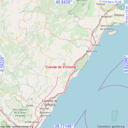
Cuevas de Vinromá GPS coordinates[2]
40° 18' 35.136" North, 0° 7' 15.024" East
| Map corner | latitude | longitude |
|---|---|---|
| Upper-left | 40.8438°, | -0.58229° |
| Center: | 40.30976°, | 0.12084° |
| Lower-right: | 39.77146°, | 0.82396° |
| Map W x H: | 119.2×119.2 km | = 74.1×74.1mi |
| max Lat: | 43.74134° ⇑65.6% North |
| Cuevas de Vinromá: | 40.30976° |
| min Lat: | ⇓34.4% South 27.64134° |
| min Long | Cuevas de Vinro | max Long |
| -18.00367° | 0.12084° | 4.2899° |
| W 87.6%⇐ | ⇒12.4% E |
Elevation
Elevation of Cuevas de Vinromá is 189 m = 620 ft, and this is 409 m = 1342 ft below average elevation for this country.
| Max E: |
1682 m = 5518 ft | 81.9% |
| Avg. | 598 m = 1962 ft | |
| Cuevas de Vinromá | 189 m = 620 ft | |
Min E: |
0 m = 0 ft | 18.1% |
See also: Spain elevation on elevation.city.
Geographical zone
Cuevas de Vinromá is located in North temperate zone (between Tropic of Cancer and the Arctic Circle). Distance of this Northern Tropic circle is 1876.1 km =1165.8 mi to South.| Distance of | km | miles | from Cuevas de Vinromá |
|---|---|---|---|
| North Pole | 5525 | 3433.1 | to North |
| Arctic Circle | 2919.1 | 1813.8 | to North |
| Tropic Cancer | 1876.1 | 1165.8 | to South |
| Equator | 4482 | 2785 | to South |


Nearby cities:
15 places around Cuevas de Vinromá: (largest is in red/bold)
• Albocàsser
8.7 km =5.4 mi,  301°
301°
• Alcalà de Xivert
9.6 km =6 mi,  96°
96°
• Alcocéber
15.3 km =9.5 mi,  115°
115°
• Benassal
23.3 km =14.5 mi,  288°
288°
• Benlloch
13.6 km =8.5 mi,  215°
215°
• Cabanes
18.3 km =11.4 mi,  201°
201°
• Catí
19.8 km =12.3 mi,  335°
335°
• Cervera del Maestre
20.7 km =12.9 mi,  39°
39°
• Chert/Xert
23.5 km =14.6 mi,  7°
7°
• Salsadella
12.9 km =8 mi,  20°
20°
• Santa Magdalena de Pulpis
16.2 km =10.1 mi,  71°
71°
• Sarratella
7.6 km =4.7 mi,  272°
272°
• Sierra-Engarcerán
12.7 km =7.9 mi,  249°
249°
• Tirig
13.1 km =8.1 mi, 343°
• Torreblanca
11.8 km =7.3 mi,  147°
147°
Sources, notices
• [Note1] Compared only with cities in Spain existing in our database
• [Src1] Map data: © OpenStreetMap contributors (CC-BY-SA)
• [Src2] Other city data from geonames.org with taken over terms of usage.
• [Src3] Geographical zone / Annual Mean Temperature by Robert A. Rohde @ Wikipedia
