Petäjävesi geodata
Petäjävesi (Central Finland) is a seat of a third-order administrative division; located in Finland in Europe/Helsinki (GMT+3) time zone. With population of 3,610 people, there are 262 cities with bigger population in this country. Compared to other cities in Finland, 57.3% of cities are located further ↓South; 59.6% of cities are located further ←West and 88.7% of cities have lower elevation than Petäjävesi. Note1


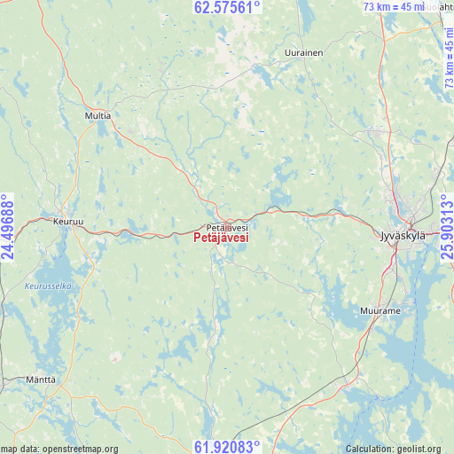
Petäjävesi GPS coordinates[2]
62° 15' 0" North, 25° 12' 0" East
| Map corner | latitude | longitude |
|---|---|---|
| Upper-left | 62.57561°, | 24.49688° |
| Center: | 62.25°, | 25.2° |
| Lower-right: | 61.92083°, | 25.90313° |
| Map W x H: | 72.8×72.8 km | = 45.2×45.2mi |
| max Lat: | 69.90864° ⇑42.7% North |
| Petäjävesi: | 62.25° |
| min Lat: | ⇓57.3% South 59.83333° |
| min Long | Petäjävesi | max Long |
| 21.2° | 25.2° | 30.93276° |
| W 59.6%⇐ | ⇒40.4% E |
Elevation
Elevation of Petäjävesi is 138 m = 453 ft, and this is 60.9 m = 200 ft above average elevation for this country.
| Max E: |
299 m = 981 ft | 11.3% |
| Petäjävesi | 138 m 453 ft | |
| Avg. | 77.1 m = 253 ft | |
Min E: |
1 m = 3 ft | 88.7% |
See also: Finland elevation on elevation.city.
Geographical zone
Petäjävesi is located in North temperate zone (between Tropic of Cancer and the Arctic Circle). Distance of this North polar circle is 479.6 km =298 mi to North.| Distance of | km | miles | from Petäjävesi |
|---|---|---|---|
| North Pole | 3085.5 | 1917.2 | to North |
| Arctic Circle | 479.6 | 298 | to North |
| Tropic Cancer | 4315.6 | 2681.6 | to South |
| Equator | 6921.6 | 4300.9 | to South |


Nearby cities:
15 places around Petäjävesi: (largest is in red/bold)
• Jyväskylä
27 km =16.8 mi,  92°
92°
• Jämsä
42.9 km =26.7 mi,  180°
180°
• Jämsänkoski
36.8 km =22.9 mi, 182°
• Keuruu
25.9 km =16.1 mi,  274°
274°
• Korpilahti
31.7 km =19.7 mi,  144°
144°
• Laukaa
42.9 km =26.7 mi,  64°
64°
• Multia
28.4 km =17.6 mi,  310°
310°
• Muurame
27.5 km =17.1 mi,  118°
118°
• Mänttä
38.5 km =23.9 mi,  230°
230°
• Suolahti
48.5 km =30.1 mi,  43°
43°
• Säynätsalo
32 km =19.9 mi,  112°
112°
• Toivakka
48.8 km =30.3 mi, 109°
• Uurainen
30.6 km =19 mi,  24°
24°
• Vilppula
44.2 km =27.5 mi, 234°
• Äänekoski
47.6 km =29.6 mi, 35°
Sources, notices
• [Note1] Compared only with cities in Finland existing in our database
• [Src1] Map data: © OpenStreetMap contributors (CC-BY-SA)
• [Src2] Other city data from geonames.org with taken over terms of usage.
• [Src3] Geographical zone / Annual Mean Temperature by Robert A. Rohde @ Wikipedia
