Thiais geodata
Thiais (Île-de-France) is a populated place; located in France in Europe/Paris (GMT+2) time zone. With population of 29,724 people, there are 274 cities with bigger population in this country. Compared to other cities in France, 74.7% of cities are located further ↓South; 51.2% of cities are located further →East and 81.5% of cities have higher elevation than Thiais. Note1
Administrative division(s):
- Level 1: Île-de-France
- Level 2: Val-de-Marne
- Level 3: Arrondissement de L'Haÿ-les-Roses
- Level 4: Thiais


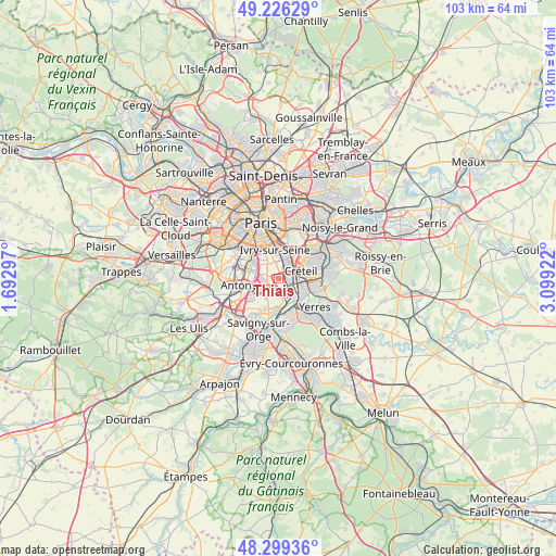
Thiais GPS coordinates[2]
48° 45' 53.856" North, 2° 23' 45.96" East
| Map corner | latitude | longitude |
|---|---|---|
| Upper-left | 49.22629°, | 1.69297° |
| Center: | 48.76496°, | 2.3961° |
| Lower-right: | 48.29936°, | 3.09922° |
| Map W x H: | 103.1×103.1 km | = 64.1×64.1mi |
| max Lat: | 51.07786° ⇑25.3% North |
| Thiais: | 48.76496° |
| min Lat: | ⇓74.7% South 41.3874° |
| min Long | Thiais | max Long |
| -5.08615° | 2.3961° | 9.52242° |
| W 48.8%⇐ | ⇒51.2% E |
Elevation
Elevation of Thiais is 51 m = 167 ft, and this is 142.7 m = 468 ft below average elevation for this country.
| Max E: |
2333 m = 7654 ft | 81.5% |
| Avg. | 193.7 m = 635 ft | |
| Thiais | 51 m = 167 ft | |
Min E: |
-1 m = -3 ft | 18.5% |
See also: France elevation on elevation.city.
Geographical zone
Thiais is located in North temperate zone (between Tropic of Cancer and the Arctic Circle). Distance of this North polar circle is 1979 km =1229.7 mi to North.| Distance of | km | miles | from Thiais |
|---|---|---|---|
| North Pole | 4584.9 | 2848.9 | to North |
| Arctic Circle | 1979 | 1229.7 | to North |
| Tropic Cancer | 2816.2 | 1749.9 | to South |
| Equator | 5422.2 | 3369.2 | to South |


Nearby cities:
15 places around Thiais: (largest is in red/bold)
• Ablon-sur-Seine
4.8 km =3 mi,  151°
151°
• Alfortville
4.9 km =3 mi,  21°
21°
• Cachan
5.6 km =3.5 mi,  308°
308°
• Chevilly-Larue
3.4 km =2.1 mi,  269°
269°
• Choisy-le-Roi
1.7 km =1.1 mi,  76°
76°
• Fresnes
5.5 km =3.4 mi,  259°
259°
• Ivry-sur-Seine
5.7 km =3.5 mi,  351°
351°
• L'Haÿ-les-Roses
5 km =3.1 mi,  293°
293°
• Orly
1.9 km =1.2 mi,  187°
187°
• Rungis
3.8 km =2.4 mi,  236°
236°
• Valenton
5.5 km =3.4 mi,  113°
113°
• Villejuif
4.2 km =2.6 mi,  320°
320°
• Villeneuve-Saint-Georges
5.3 km =3.3 mi,  133°
133°
• Villeneuve-le-Roi
3.1 km =1.9 mi,  173°
173°
• Vitry-sur-Seine
2.5 km =1.6 mi,  12°
12°
Sources, notices
• [Note1] Compared only with cities in France existing in our database
• [Src1] Map data: © OpenStreetMap contributors (CC-BY-SA)
• [Src2] Other city data from geonames.org with taken over terms of usage.
• [Src3] Geographical zone / Annual Mean Temperature by Robert A. Rohde @ Wikipedia
