Villers-Saint-Sépulcre geodata
Villers-Saint-Sépulcre (Hauts-de-France) is a populated place; located in France in Europe/Paris (GMT+2) time zone. With population of 902 people, there are 9633 cities with bigger population in this country. Compared to other cities in France, 87.3% of cities are located further ↓South; 54.2% of cities are located further →East and 73.1% of cities have higher elevation than Villers-Saint-Sépulcre. Note1
Administrative division(s):
- Level 1: Hauts-de-France
- Level 2: Département de l'Oise
- Level 3: Arrondissement de Beauvais
- Level 4: Villers-Saint-Sépulcre
Current local time in Villers-Saint-Sépulcre:
06:09 AM, SaturdayDifference from your time zone: hours


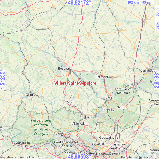
Villers-Saint-Sépulcre GPS coordinates[2]
49° 21' 57.456" North, 2° 12' 55.692" East
| Map corner | latitude | longitude |
|---|---|---|
| Upper-left | 49.82172°, | 1.51235° |
| Center: | 49.36596°, | 2.21547° |
| Lower-right: | 48.90593°, | 2.9186° |
| Map W x H: | 101.8×101.8 km | = 63.3×63.3mi |
| max Lat: | 51.07786° ⇑12.7% North |
| Villers-Saint-Sépulcre: | 49.36596° |
| min Lat: | ⇓87.3% South 41.3874° |
| min Long | Villers-Saint-S | max Long |
| -5.08615° | 2.21547° | 9.52242° |
| W 45.8%⇐ | ⇒54.2% E |
Elevation
Elevation of Villers-Saint-Sépulcre is 71 m = 233 ft, and this is 122.7 m = 403 ft below average elevation for this country.
| Max E: |
2333 m = 7654 ft | 73.1% |
| Avg. | 193.7 m = 635 ft | |
| Villers-Saint-Sépulcre | 71 m = 233 ft | |
Min E: |
-1 m = -3 ft | 26.9% |
See also: France elevation on elevation.city.
Geographical zone
Villers-Saint-Sépulcre is located in North temperate zone (between Tropic of Cancer and the Arctic Circle). Distance of this North polar circle is 1912.2 km =1188.2 mi to North.| Distance of | km | miles | from Villers-Saint-Sépulcre |
|---|---|---|---|
| North Pole | 4518.1 | 2807.4 | to North |
| Arctic Circle | 1912.2 | 1188.2 | to North |
| Tropic Cancer | 2883.1 | 1791.5 | to South |
| Equator | 5489 | 3410.7 | to South |


Nearby cities:
15 places around Villers-Saint-Sépulcre: (largest is in red/bold)
• Bailleul-sur-Thérain
2.2 km =1.4 mi,  13°
13°
• Berthecourt
1.8 km =1.1 mi,  158°
158°
• Bresles
5.5 km =3.4 mi,  26°
26°
• Cauvigny
7.5 km =4.7 mi, 161°
• Heilles
5 km =3.1 mi,  133°
133°
• Hermes
2.2 km =1.4 mi,  106°
106°
• Hondainville
6.9 km =4.3 mi, 114°
• Laversines
6.7 km =4.2 mi,  348°
348°
• Noailles
4.3 km =2.7 mi,  194°
194°
• Ponchon
2.6 km =1.6 mi,  212°
212°
• Rochy-Condé
4.5 km =2.8 mi,  330°
330°
• Saint-Félix
5 km =3.1 mi,  100°
100°
• Saint-Sulpice
6.9 km =4.3 mi,  255°
255°
• Therdonne
7.2 km =4.5 mi,  324°
324°
• Warluis
5.9 km =3.7 mi,  295°
295°
Sources, notices
• [Note1] Compared only with cities in France existing in our database
• [Src1] Map data: © OpenStreetMap contributors (CC-BY-SA)
• [Src2] Other city data from geonames.org with taken over terms of usage.
• [Src3] Geographical zone / Annual Mean Temperature by Robert A. Rohde @ Wikipedia
