Bailleul-sur-Thérain geodata
Bailleul-sur-Thérain (Hauts-de-France) is a populated place; located in France in Europe/Paris (GMT+2) time zone. With population of 2,045 people, there are 4692 cities with bigger population in this country. Compared to other cities in France, 87.6% of cities are located further ↓South; 54% of cities are located further →East and 80.6% of cities have higher elevation than Bailleul-sur-Thérain. Note1
Administrative division(s):
- Level 1: Hauts-de-France
- Level 2: Département de l'Oise
- Level 3: Arrondissement de Beauvais
- Level 4: Bailleul-sur-Thérain


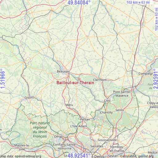
Bailleul-sur-Thérain GPS coordinates[2]
49° 23' 6.936" North, 2° 13' 22.044" East
| Map corner | latitude | longitude |
|---|---|---|
| Upper-left | 49.84084°, | 1.51966° |
| Center: | 49.38526°, | 2.22279° |
| Lower-right: | 48.92541°, | 2.92591° |
| Map W x H: | 101.8×101.8 km | = 63.3×63.3mi |
| max Lat: | 51.07786° ⇑12.4% North |
| Bailleul-sur-Thérain: | 49.38526° |
| min Lat: | ⇓87.6% South 41.3874° |
| min Long | Bailleul-sur-Th | max Long |
| -5.08615° | 2.22279° | 9.52242° |
| W 46%⇐ | ⇒54% E |
Elevation
Elevation of Bailleul-sur-Thérain is 53 m = 174 ft, and this is 140.7 m = 462 ft below average elevation for this country.
| Max E: |
2333 m = 7654 ft | 80.6% |
| Avg. | 193.7 m = 635 ft | |
| Bailleul-sur-Thérain | 53 m = 174 ft | |
Min E: |
-1 m = -3 ft | 19.4% |
See also: France elevation on elevation.city.
Geographical zone
Bailleul-sur-Thérain is located in North temperate zone (between Tropic of Cancer and the Arctic Circle). Distance of this North polar circle is 1910 km =1186.8 mi to North.| Distance of | km | miles | from Bailleul-sur-Thérain |
|---|---|---|---|
| North Pole | 4515.9 | 2806 | to North |
| Arctic Circle | 1910 | 1186.8 | to North |
| Tropic Cancer | 2885.2 | 1792.8 | to South |
| Equator | 5491.1 | 3412 | to South |


Nearby cities:
15 places around Bailleul-sur-Thérain: (largest is in red/bold)
• Berthecourt
3.8 km =2.4 mi,  177°
177°
• Bresles
3.4 km =2.1 mi,  35°
35°
• Heilles
6.4 km =4 mi,  150°
150°
• Hermes
3.2 km =2 mi, 150°
• Hondainville
7.6 km =4.7 mi,  130°
130°
• La Neuville-en-Hez
7.7 km =4.8 mi,  74°
74°
• La Rue-Saint-Pierre
5.9 km =3.7 mi,  62°
62°
• Laversines
4.8 km =3 mi,  337°
337°
• Noailles
6.5 km =4 mi,  194°
194°
• Ponchon
4.7 km =2.9 mi,  203°
203°
• Rochy-Condé
3.3 km =2.1 mi,  302°
302°
• Saint-Félix
5.3 km =3.3 mi,  124°
124°
• Therdonne
5.9 km =3.7 mi,  308°
308°
• Villers-Saint-Sépulcre
2.2 km =1.4 mi, 193°
• Warluis
5.8 km =3.6 mi,  273°
273°
Sources, notices
• [Note1] Compared only with cities in France existing in our database
• [Src1] Map data: © OpenStreetMap contributors (CC-BY-SA)
• [Src2] Other city data from geonames.org with taken over terms of usage.
• [Src3] Geographical zone / Annual Mean Temperature by Robert A. Rohde @ Wikipedia
