Sotteville-lès-Rouen geodata
Sotteville-lès-Rouen (Normandy) is a populated place; located in France in Europe/Paris (GMT+2) time zone. With population of 30,619 people, there are 264 cities with bigger population in this country. Compared to other cities in France, 88.1% of cities are located further ↓South; 67.9% of cities are located further →East and 95.4% of cities have higher elevation than Sotteville-lès-Rouen. Note1
Administrative division(s):
- Level 1: Normandy
- Level 2: Seine-Maritime
- Level 3: Arrondissement de Rouen
- Level 4: Sotteville-lès-Rouen


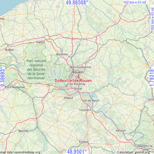
Sotteville-lès-Rouen GPS coordinates[2]
49° 24' 34.992" North, 1° 5' 24.18" East
| Map corner | latitude | longitude |
|---|---|---|
| Upper-left | 49.86508°, | 0.38693° |
| Center: | 49.40972°, | 1.09005° |
| Lower-right: | 48.9501°, | 1.79318° |
| Map W x H: | 101.7×101.7 km | = 63.2×63.2mi |
| max Lat: | 51.07786° ⇑11.9% North |
| Sotteville-lès-Rouen: | 49.40972° |
| min Lat: | ⇓88.1% South 41.3874° |
| min Long | Sotteville-lès | max Long |
| -5.08615° | 1.09005° | 9.52242° |
| W 32.1%⇐ | ⇒67.9% E |
Elevation
Elevation of Sotteville-lès-Rouen is 16 m = 52 ft, and this is 177.7 m = 583 ft below average elevation for this country.
| Max E: |
2333 m = 7654 ft | 95.4% |
| Avg. | 193.7 m = 635 ft | |
| Sotteville-lès-Rouen | 16 m = 52 ft | |
Min E: |
-1 m = -3 ft | 4.6% |
See also: France elevation on elevation.city.
Geographical zone
Sotteville-lès-Rouen is located in North temperate zone (between Tropic of Cancer and the Arctic Circle). Distance of this North polar circle is 1907.3 km =1185.1 mi to North.| Distance of | km | miles | from Sotteville-lès-Rouen |
|---|---|---|---|
| North Pole | 4513.2 | 2804.4 | to North |
| Arctic Circle | 1907.3 | 1185.1 | to North |
| Tropic Cancer | 2887.9 | 1794.5 | to South |
| Equator | 5493.8 | 3413.7 | to South |


Nearby cities:
15 places around Sotteville-lès-Rouen: (largest is in red/bold)
• Amfreville-la-Mi-Voie
3.5 km =2.2 mi,  93°
93°
• Belbeuf
4.5 km =2.8 mi,  122°
122°
• Bihorel
5.5 km =3.4 mi,  25°
25°
• Bois-Guillaume
6.1 km =3.8 mi,  22°
22°
• Canteleu
5.9 km =3.7 mi,  305°
305°
• Darnétal
5.9 km =3.7 mi,  48°
48°
• Le Grand-Quevilly
3.4 km =2.1 mi,  252°
252°
• Le Mesnil-Esnard
4 km =2.5 mi,  84°
84°
• Le Petit-Quevilly
2.1 km =1.3 mi,  281°
281°
• Mont-Saint-Aignan
5.9 km =3.7 mi,  2°
2°
• Petit-Couronne
6.1 km =3.8 mi,  241°
241°
• Rouen
3.8 km =2.4 mi,  10°
10°
• Saint-Aubin-Épinay
5.6 km =3.5 mi, 82°
• Saint-Léger-du-Bourg-Denis
5.6 km =3.5 mi,  61°
61°
• Saint-Étienne-du-Rouvray
3.7 km =2.3 mi,  163°
163°
Sources, notices
• [Note1] Compared only with cities in France existing in our database
• [Src1] Map data: © OpenStreetMap contributors (CC-BY-SA)
• [Src2] Other city data from geonames.org with taken over terms of usage.
• [Src3] Geographical zone / Annual Mean Temperature by Robert A. Rohde @ Wikipedia
