Signes geodata
Signes (Provence-Alpes-Côte d'Azur) is a populated place; located in France in Europe/Paris (GMT+2) time zone. With population of 2,202 people, there are 4362 cities with bigger population in this country. Compared to other cities in France, 95.9% of cities are located further ↑North; 85.6% of cities are located further ←West and 84.6% of cities have lower elevation than Signes. Note1
Administrative division(s):
- Level 1: Provence-Alpes-Côte d'Azur
- Level 2: Var
- Level 3: Arrondissement de Toulon
- Level 4: Signes


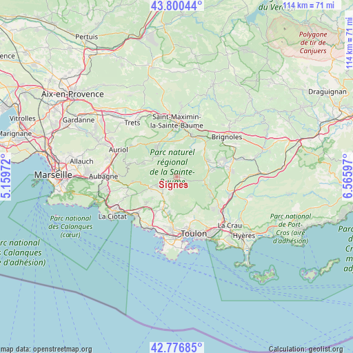
Signes GPS coordinates[2]
43° 17' 26.88" North, 5° 51' 46.224" East
| Map corner | latitude | longitude |
|---|---|---|
| Upper-left | 43.80044°, | 5.15972° |
| Center: | 43.2908°, | 5.86284° |
| Lower-right: | 42.77685°, | 6.56597° |
| Map W x H: | 113.8×113.8 km | = 70.7×70.7mi |
| max Lat: | 51.07786° ⇑95.9% North |
| Signes: | 43.2908° |
| min Lat: | ⇓4.1% South 41.3874° |
| min Long | Signes | max Long |
| -5.08615° | 5.86284° | 9.52242° |
| W 85.6%⇐ | ⇒14.4% E |
Elevation
Elevation of Signes is 341 m = 1119 ft, and this is 147.3 m = 483 ft above average elevation for this country.
| Max E: |
2333 m = 7654 ft | 15.4% |
| Signes | 341 m 1119 ft | |
| Avg. | 193.7 m = 635 ft | |
Min E: |
-1 m = -3 ft | 84.6% |
See also: France elevation on elevation.city.
Geographical zone
Signes is located in North temperate zone (between Tropic of Cancer and the Arctic Circle). Distance of this Northern Tropic circle is 2207.6 km =1371.7 mi to South.| Distance of | km | miles | from Signes |
|---|---|---|---|
| North Pole | 5193.6 | 3227.2 | to North |
| Arctic Circle | 2587.7 | 1607.9 | to North |
| Tropic Cancer | 2207.6 | 1371.7 | to South |
| Equator | 4813.5 | 2991 | to South |


Nearby cities:
15 places around Signes: (largest is in red/bold)
• Belgentier
12.2 km =7.6 mi,  114°
114°
• Cuges-les-Pins
13.3 km =8.3 mi,  262°
262°
• Garéoult
15.4 km =9.6 mi,  74°
74°
• La Roquebrussanne
10.7 km =6.6 mi,  58°
58°
• Le Beausset
11.4 km =7.1 mi,  205°
205°
• Le Castellet
12 km =7.5 mi,  215°
215°
• Le Revest-les-Eaux
13.8 km =8.6 mi,  157°
157°
• Mazaugues
8 km =5 mi,  36°
36°
• Méounes-lès-Montrieux
8.7 km =5.4 mi,  97°
97°
• Nans-les-Pins
11 km =6.8 mi,  323°
323°
• Néoules
11.9 km =7.4 mi,  80°
80°
• Plan-d'Aups-Sainte-Baume
12.7 km =7.9 mi,  291°
291°
• Rougiers
11.3 km =7 mi,  355°
355°
• Tourves
13.9 km =8.6 mi,  20°
20°
• Évenos
14.2 km =8.8 mi,  185°
185°
Sources, notices
• [Note1] Compared only with cities in France existing in our database
• [Src1] Map data: © OpenStreetMap contributors (CC-BY-SA)
• [Src2] Other city data from geonames.org with taken over terms of usage.
• [Src3] Geographical zone / Annual Mean Temperature by Robert A. Rohde @ Wikipedia
