Saint-Laurent-les-Tours geodata
Saint-Laurent-les-Tours (Occitanie) is a populated place; located in France in Europe/Paris (GMT+2) time zone. With population of 914 people, there are 9537 cities with bigger population in this country. Compared to other cities in France, 80.7% of cities are located further ↑North; 58.3% of cities are located further →East and 72.4% of cities have lower elevation than Saint-Laurent-les-Tours. Note1
Administrative division(s):
- Level 1: Occitanie
- Level 2: Lot
- Level 3: Arrondissement de Figeac
- Level 4: Saint-Laurent-les-Tours
Current local time in Saint-Laurent-les-Tours:
10:02 AM, SaturdayDifference from your time zone: hours


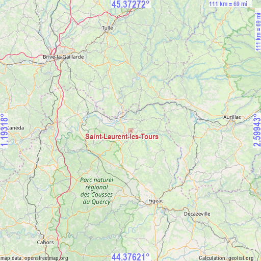
Saint-Laurent-les-Tours GPS coordinates[2]
44° 52' 35.832" North, 1° 53' 46.68" East
| Map corner | latitude | longitude |
|---|---|---|
| Upper-left | 45.37272°, | 1.19318° |
| Center: | 44.87662°, | 1.8963° |
| Lower-right: | 44.37621°, | 2.59943° |
| Map W x H: | 110.8×110.8 km | = 68.8×68.8mi |
| max Lat: | 51.07786° ⇑80.7% North |
| Saint-Laurent-les-Tours: | 44.87662° |
| min Lat: | ⇓19.3% South 41.3874° |
| min Long | Saint-Laurent-l | max Long |
| -5.08615° | 1.8963° | 9.52242° |
| W 41.7%⇐ | ⇒58.3% E |
Elevation
Elevation of Saint-Laurent-les-Tours is 232 m = 761 ft, and this is 38.3 m = 126 ft above average elevation for this country.
| Max E: |
2333 m = 7654 ft | 27.6% |
| Saint-Laurent-les-Tours | 232 m 761 ft | |
| Avg. | 193.7 m = 635 ft | |
Min E: |
-1 m = -3 ft | 72.4% |
See also: France elevation on elevation.city.
Geographical zone
Saint-Laurent-les-Tours is located in North temperate zone (between Tropic of Cancer and the Arctic Circle). Distance of this Northern Tropic circle is 2383.9 km =1481.3 mi to South.| Distance of | km | miles | from Saint-Laurent-les-Tours |
|---|---|---|---|
| North Pole | 5017.2 | 3117.5 | to North |
| Arctic Circle | 2411.4 | 1498.4 | to North |
| Tropic Cancer | 2383.9 | 1481.3 | to South |
| Equator | 4989.8 | 3100.5 | to South |


Nearby cities:
15 places around Saint-Laurent-les-Tours: (largest is in red/bold)
• Altillac
11.9 km =7.4 mi,  341°
341°
• Alvignac
16.8 km =10.4 mi,  250°
250°
• Aynac
10.8 km =6.7 mi,  198°
198°
• Beaulieu-sur-Dordogne
12.2 km =7.6 mi, 338°
• Biars-sur-Cère
6.4 km =4 mi,  328°
328°
• Bretenoux
6.1 km =3.8 mi,  313°
313°
• Bétaille
14.8 km =9.2 mi,  300°
300°
• Lacapelle-Marival
16.7 km =10.4 mi,  172°
172°
• Latronquière
16.6 km =10.3 mi,  120°
120°
• Leyme
10.1 km =6.3 mi,  178°
178°
• Prudhomat
6 km =3.7 mi,  293°
293°
• Puybrun
9.8 km =6.1 mi, 298°
• Saint-Céré
2.2 km =1.4 mi, 184°
• Sousceyrac
11 km =6.8 mi,  91°
91°
• Vayrac
17.4 km =10.8 mi, 299°
Sources, notices
• [Note1] Compared only with cities in France existing in our database
• [Src1] Map data: © OpenStreetMap contributors (CC-BY-SA)
• [Src2] Other city data from geonames.org with taken over terms of usage.
• [Src3] Geographical zone / Annual Mean Temperature by Robert A. Rohde @ Wikipedia
