Leyme geodata
Leyme (Occitanie) is a populated place; located in France in Europe/Paris (GMT+2) time zone. With population of 1,013 people, there are 8749 cities with bigger population in this country. Compared to other cities in France, 81.5% of cities are located further ↑North; 58.3% of cities are located further →East and 91.9% of cities have lower elevation than Leyme. Note1
Administrative division(s):
- Level 1: Occitanie
- Level 2: Lot
- Level 3: Arrondissement de Figeac
- Level 4: Leyme


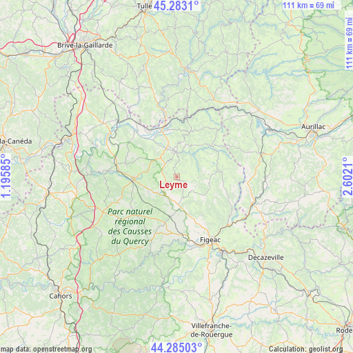
Leyme GPS coordinates[2]
44° 47' 10.392" North, 1° 53' 56.292" East
| Map corner | latitude | longitude |
|---|---|---|
| Upper-left | 45.2831°, | 1.19585° |
| Center: | 44.78622°, | 1.89897° |
| Lower-right: | 44.28503°, | 2.6021° |
| Map W x H: | 111×111 km | = 69×69mi |
| max Lat: | 51.07786° ⇑81.5% North |
| Leyme: | 44.78622° |
| min Lat: | ⇓18.5% South 41.3874° |
| min Long | Leyme | max Long |
| -5.08615° | 1.89897° | 9.52242° |
| W 41.7%⇐ | ⇒58.3% E |
Elevation
Elevation of Leyme is 474 m = 1555 ft, and this is 280.3 m = 920 ft above average elevation for this country.
| Max E: |
2333 m = 7654 ft | 8.1% |
| Leyme | 474 m 1555 ft | |
| Avg. | 193.7 m = 635 ft | |
Min E: |
-1 m = -3 ft | 91.9% |
See also: France elevation on elevation.city.
Geographical zone
Leyme is located in North temperate zone (between Tropic of Cancer and the Arctic Circle). Distance of this Northern Tropic circle is 2373.8 km =1475 mi to South.| Distance of | km | miles | from Leyme |
|---|---|---|---|
| North Pole | 5027.3 | 3123.8 | to North |
| Arctic Circle | 2421.4 | 1504.6 | to North |
| Tropic Cancer | 2373.8 | 1475 | to South |
| Equator | 4979.8 | 3094.3 | to South |


Nearby cities:
15 places around Leyme: (largest is in red/bold)
• Alvignac
16.7 km =10.4 mi,  285°
285°
• Assier
12.5 km =7.8 mi,  188°
188°
• Aynac
3.7 km =2.3 mi,  267°
267°
• Biars-sur-Cère
16 km =9.9 mi,  347°
347°
• Bretenoux
15 km =9.3 mi,  341°
341°
• Cardaillac
14.2 km =8.8 mi,  146°
146°
• Gramat
14.2 km =8.8 mi, 267°
• Lacapelle-Marival
6.8 km =4.2 mi,  162°
162°
• Latronquière
14.2 km =8.8 mi,  83°
83°
• Livernon
16.1 km =10 mi,  196°
196°
• Prudhomat
13.7 km =8.5 mi, 335°
• Puybrun
17.2 km =10.7 mi,  329°
329°
• Saint-Céré
7.9 km =4.9 mi,  357°
357°
• Saint-Laurent-les-Tours
10.1 km =6.3 mi, 358°
• Sousceyrac
14.5 km =9 mi,  48°
48°
Sources, notices
• [Note1] Compared only with cities in France existing in our database
• [Src1] Map data: © OpenStreetMap contributors (CC-BY-SA)
• [Src2] Other city data from geonames.org with taken over terms of usage.
• [Src3] Geographical zone / Annual Mean Temperature by Robert A. Rohde @ Wikipedia
